Available Copies from Independent Booksellers

Price: US$137.03 + shipping
Description: Poor copy, wear and tear as with age. Boards detached. Text remains in fine condition. Physical description; 1 v. : fronts., ill., plates. Subjects; Wilkes, Charles 1798-1877 Travel. United States Exploring Expedition (1838-1842). Discoveries in geography. Scientific expeditions. 3 Kg.
Seller: MW Books Ltd., Galway, Ireland

Price: US$150.00 + shipping
Condition: Good
Description: This is volume 1 only. 1845 first edition. Bound in brown half leather, with raised leather bands on the spines and marbled paper over boards. The back cover has been repaired, with some cheesecloth showing inside the back joint. The binding is tight. Beautifully illustrated with steel-engraved plates throughout. There are also quite a few woodcut illustrations and a couple of maps. This is volume one of the five-volume set. The exploring expedition was in South America in Brazil, Peru, Chile and surrounding areas.; 434 pages
Seller: Orrin Schwab Books, Providence, UT, U.S.A.
Price: US$150.00 + shipping
Condition: Very Good
Description: 539pp, b/w engraved illustrations, folding map, halfbound octavo with brown leather spine and corners with blue cloth boards. rubbing wear bottom fore-edge corners with underboard mildly exposed, minor wear to leather edges, light fading to spine, light chipping top title block on spine, binding solid and strong, light toning to endpapers, owner name, text clean throughout.
Seller: COLLINS BOOKS, Seattle, WA, U.S.A.

Price: US$160.00 + shipping
Description: Poor copy, wear and tear as with age. Boards detached. Text remains in fine condition. Physical description; 1 v. : fronts., ill., plates. Subjects; Wilkes, Charles 1798-1877 Travel. United States Exploring Expedition (1838-1842). Discoveries in geography. Scientific expeditions. 3 Kg.
Seller: MW Books, New York, NY, U.S.A.

Price: US$165.00 + shipping
Condition: Good
Description: Good hardcover, no DJ. Ex-historical society library. Quarter leather with pseudo-marbled paper over boards; raised bands on spine with gilt designs and titles; nonpareil marbled paper end papers. Brown cloth tape over joints and on hinges; scuffed covers with some edge wear; tightly bound; book plate on front paste down; clean interior with occasional light foxing, small stains. Fold out maps and charts intact and in good condition. Includes list of all officers, scientific crew and seaman and when and where they shipped from. Many woodcuts throughout. Large 8vo, 434 pp.
Seller: Lee Madden, Book Dealer, Brattleboro, VT, U.S.A.

Price: US$165.00 + shipping
Condition: Good
Description: Good hardcover, no DJ. Ex-historical society library. Quarter leather with pseudo-marbled paper over boards; raised bands on spine with gilt designs and titles; nonpareil marbled paper end papers. Brown cloth tape over joints and on hinges; scuffed covers with some edge wear; tightly bound; book plate on front paste down; clean interior with occasional light foxing, small stains. Fold out map intact and in good condition. Many woodcuts throughout. Large 8vo, 438 pp + 16 pp adverts
Seller: Lee Madden, Book Dealer, Brattleboro, VT, U.S.A.
Price: US$250.00 + shipping
Condition: Very Good
Description: 1/2 brown leather over blue green cloth,black labels w/ gilt printing on spine,558 pages for this volume 5,minor handling and bumping,minor foxing to prelims, all maps and plates present
Seller: mauna kea books, kurtistown, HI, U.S.A.
Price: US$250.00 + shipping
Condition: Very Good
Description: 1/2 brown leather over blue green cloth,black labels w/ gilt printing on spine,476 pages for this volume 2,minor handling and bumping,minor foxing to prelims, all maps and plates present
Seller: mauna kea books, kurtistown, HI, U.S.A.
Price: US$250.00 + shipping
Condition: Very Good
Description: 1/2 brown leather over blue green cloth,black labels w/ gilt printing on spine,438 pages for this volume 3,minor handling and bumping,minor foxing to prelims, all maps and plates present
Seller: mauna kea books, kurtistown, HI, U.S.A.
Price: US$250.00 + shipping
Condition: Very Good
Description: 1/2 brown leather over blue green cloth,black labels w/ gilt printing on spine,434 pages for this volume 1,minor handling and bumping,minor foxing to prelims,small ink stain to bottom outside corner of last 200 pages of text block, not affecting text, all maps and plates present
Seller: mauna kea books, kurtistown, HI, U.S.A.
Price: US$256.17 + shipping
Condition: Fair
Description: Vols 1 & 2 of 5 only. lx+434pp & xv+476pp with numerous engravings in text. embossed black cloth. both lack spines with front covers & first few pages loose. ex-library with stamp.
Seller: Arthur Probsthain, London, United Kingdom
Price: US$300.00 + shipping
Condition: Good
Description: Volumes II and V of five. Vol. II. 476 pp. with three fold-out maps. Vol. V. 558 pp. with three fold-out maps. Bound in full contemporary calf. Bindings well rubbed but solid. Offset throughout with scattered foxing.
Seller: Moroccobound Fine Books, IOBA, Lewis Center, OH, U.S.A.
Price: US$300.00 + shipping
Description: 539pp, b/w engraved illustrations, maps, leatherbound quarto. heavy scuffing and wear to leather covers, darkening to bottom spine, binding remains solid, owner name, foxing to interior, clean thoughout, Good +
Seller: COLLINS BOOKS, Seattle, WA, U.S.A.
Price: US$300.00 + shipping
Description: 434pp, b/w engraved illustrations, maps, leatherbound quarto. scuffing and wear to bottom rear leather covers, corners bumped, binding remains solid, owner name, foxing to interior, clean thoughout, Good +
Seller: COLLINS BOOKS, Seattle, WA, U.S.A.
Price: US$315.72 + shipping
Description: 2 Bände. 434 S., 476 S. Mit zahlr. Text-Holzschnitten, 3 Tabellen und 3 Karten. Orig.-Leinwand. Berieben, Kapitale rissig u. mit Fehlstelle, stockfl. Sprache: Deutsch
Seller: Antiquariat Kunsthaus-Adlerstrasse, Stuttgart, Germany
Price: US$700.00 + shipping
Condition: Good
Description: Third edition (of 1,000 copies) following the first two issues of 100 and 150 copies respectively. Published in five volumes with an atlas, offered here is Vol. I only. Pages are uncut and measure eleven by seven inches. Bound in original black paper boards with leather spine and corners. Top edge gilt. Boards are a bit rough, and there's significant wear to the leather, particularly the spine which also has a 1.25 inch triangular-shaped piece missing at the crown. Contents however, in rather nice shape. Front endpage has a brief gift inscription and previous owner blindstamp. No other marks or writing throughout. The map and all plates and tissue guards are present. There's some mild to moderate offsetting from the plates and wood-cut illustrations and a bit of sporadic foxing, largely confined to the margins. Text is for the most part clean and bright. No tears or chipping to any of the pages. Binding is solid and tight, making this an excellent candidate for re-case.
Seller: Brazos Bend Books, Houston, TX, U.S.A.
Price: US$700.00 + shipping
Condition: Good
Description: Third edition (of 1,000 copies) following the first two issues of 100 and 150 copies respectively. Published in five volumes with an atlas, offered here is Vol. III only. Pages are uncut and measure eleven by seven inches. Bound in original black paper boards with leather spine and corners. Top edge gilt. Boards are a bit rough, and there's significant wear to the leather, particularly the heavily rubbed spine. Contents however, in rather nice shape. Front endpage has a previous owner blindstamp to bottom corner. No other marks or writing throughout. All plates and tissue guards are present. There's some mild to moderate offsetting from the plates and wood-cut illustrations and a bit of sporadic foxing, largely confined to the margins. Text is for the most part clean and bright. No tears or chipping to any of the pages. Binding is solid and tight, making this an excellent candidate for re-case.
Seller: Brazos Bend Books, Houston, TX, U.S.A.
Price: US$700.00 + shipping
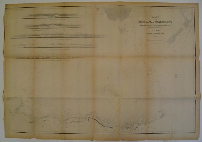
Description: Sea chart. Uncolored lithograph. Image measures 23" x 35". Rare sea chart showing the northern coast of Antarctica. Includes 5 profile views and the paths of four of his ships, the Vincennes, the Peacock, the Porpoise and the Flying Fish. This chart was published in Wilkes' "Narrative of the United States Exploring Expedition During the Years 1838, 1839, 1840, 1841, 1842" (1845), which describes his explorations and cultural encounters in mapping the South Seas, the American west, parts of South America, the East Indies and Antarctica. Charles Wilkes (1798-1877) was an impressively successful American explorer. Folding map in 21 sections. Chipping and minor tears to edges. Toning along all folds. Left margin cropped.
Seller: Argosy Book Store, ABAA, ILAB, New York, NY, U.S.A.
Price: US$750.00 + shipping
Condition: Very Good
Description: all books are vg emblem on front and gold anchor on spine solid and tight with 10 maps and other fold outs small booklet at end of vol 5 vol 1 has a rebound spine in tan leather
Seller: Arader Galleries of Philadelphia, PA, Philadelphia, PA, U.S.A.

Price: US$1161.22 + shipping
Condition: Very Good
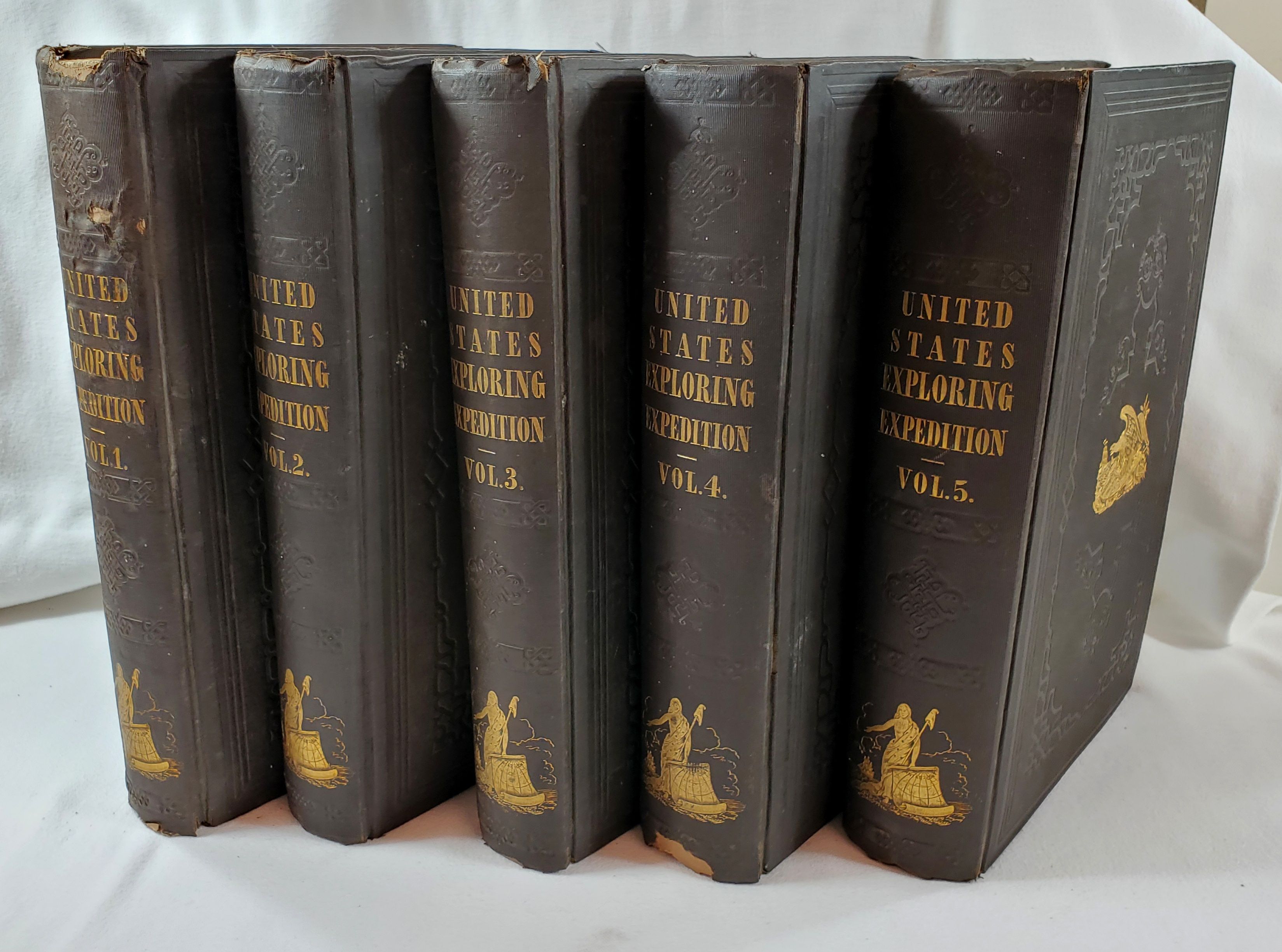
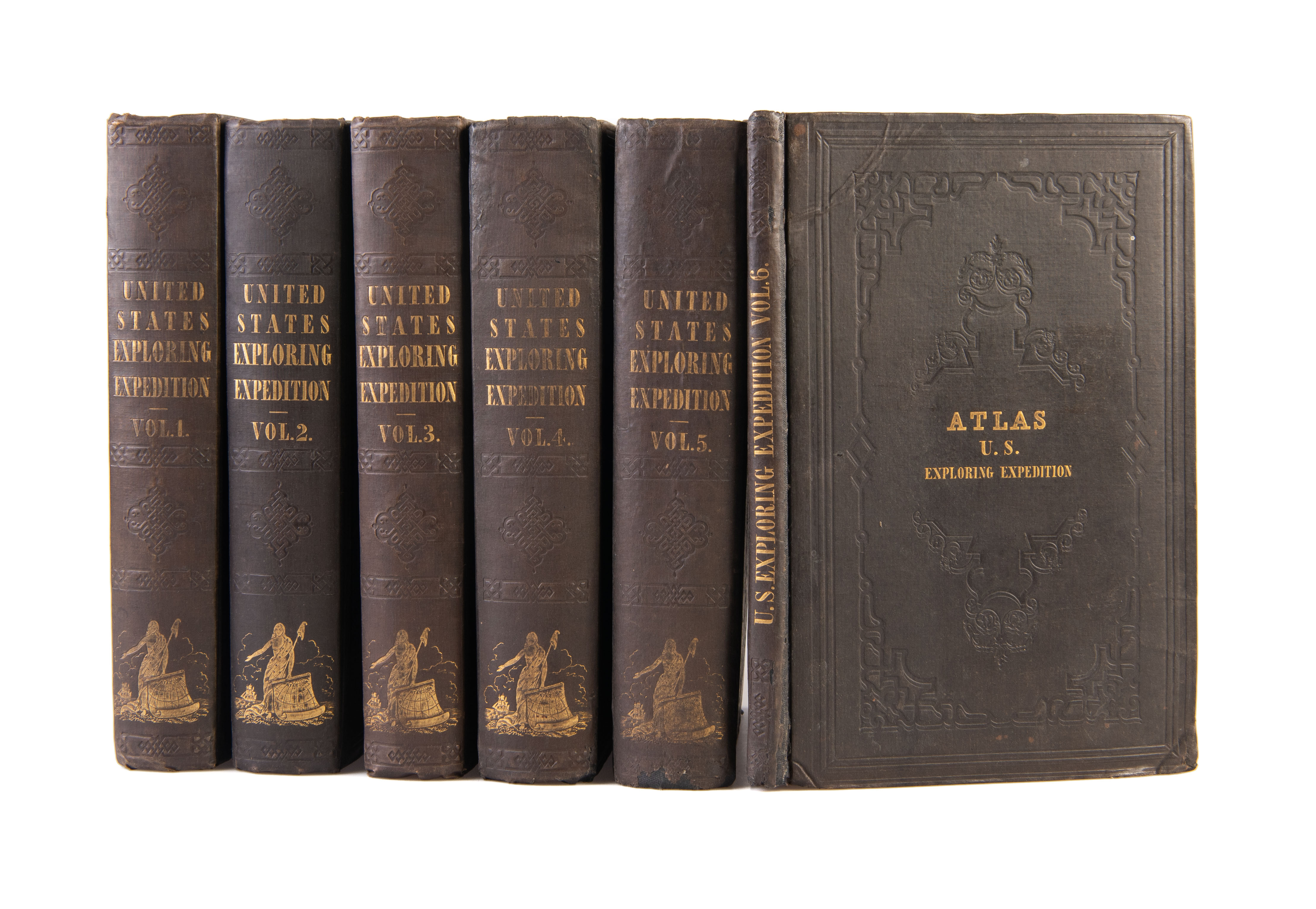
Description: All five clothbound volumes in Very Good condition; no jackets; some wear to tipped-on leather labels on spine; foxing on interior pages as to be expected with age; two fold-out frontispieces intact; due to professional rebinding, covers are clean and bindings tight. More photos available upon request. This five-volume 1845 edition was reprinted from the stereotype plates of the original 1844 edition and published without an atlas.The volumes have been professionally rebound in brown cloth with tipped-on leather and gilt lettering on the spine. Illustrations and maps in all volumes; approx. 2,500 total pages. All volumes are clean, intact, and in nice condition.
Seller: Tornbooks, Austin, TX, U.S.A.

Price: US$1191.05 + shipping
Description: during the years 1838, 1839, 1840, 1841, 1842. With illustrations and maps. In five volumes. Pp. lvi+434+xii+476+xii+438+xiv+540+xii+558 (each volume lacking the half-title page), 11 maps (10 folding), 3 folding tables, woodcut text illustrations, printed music, appendices, index; rebound in modern dark brown half leather, the spines lettered in gilt and decorated in blind, light brown cloth boards; later endpapers; bookseller's sticker at head of upper pastedown Volumes I & II (and traces of removal of small sticker in the other volumes), the lower hinge cracking Volumes III & IV, all the folding maps and tables plus the title pages and the final text page in Volume IV neatly reinforced with cloth on the reverse, a few leaves lightly creased, a couple of small edge splits, chips or tears, the bottom fore-corner of pages 441/2 in Volume V reinserted with early paper repair (not affecting text), a few mainly small damp stains, scattered foxing, browning and soiling; Lea and Blanchard, Philadelphia,1845. Third (second octavo) edition. Haskell 3; Hocken p. 125; F.4208. *First published in a very limited edition (100 copies) in 1844, more than a dozen editions were published in the years prior to the civil war. The present edition was reprinted, unabridged, from stereotypes of the second (imperial octavo) edition, but was issued without the plates and the separate atlas volume, and with the text illustrations being woodcuts instead of steel engravings. Beginning in 1838, the Wilkes expedition was the first national U.S. exploring expedition, and played a major role in the development of 19th century science. The expedition personnel included several scientists, who collected thousands of plant and bird specimens, which later formed the basis of collections at the Smithsonian Institution. The expedition circumnavigated the globe, notably exploring the coast of the Antarctic continent, the islands of the Pacific Ocean, and the American northwest coast. Three chapters in Volume II (pp. 157-277) deal with New South Wales.
Seller: Kay Craddock - Antiquarian Bookseller, Melbourne, VIC, Australia
Price: US$1500.00 + shipping
Description: Five volume set. 434, 476, 438, 539, 558pp. Octavo [24.5 cm] Original brown cloth with decorative blind floral stamping to front and rear boards. Tittles gilt stamped on the backstrip with gilt stamped anchor. Gilt stamped eagle and shield on front boards. All volumes very good with some minor wear to boards, particularly at the corners. Light sporadic foxing throughout. Major Exploration work in nice shape. Lacking atlas volume, otherwise complete. Howes W414. Sabin 103994.
Seller: Ken Sanders Rare Books, ABAA, Salt Lake City, UT, U.S.A.
Price: US$2000.00 + shipping
Description: Engravings, folding charts and folding maps Very good. Lightly rubbed and bumped. A few tiny scuffs. Light uniform foxing throughout
Seller: Weller Book Works, A.B.A.A., Salt Lake City, UT, U.S.A.
Price: US$2454.99 + shipping
Condition: Good
Description: Philadelphia: Lea & Blanchard, 1845. First edition available to the public, 1845. Five volumes, lacks the atlas. Publisher's original cloth, five imposing volumes with page size approximately 11" x 7", some volumes with a large number of unopened page edges. Includes all the steel plate engravings and maps called for in the five volumes of text, half-titles included in each volume. Dark brown cloth with gilt spine lettering and gilt vignettes of eagle, shield and ship on covers and woman with map and ship on spine, additional cover decoration in blind, edges untrimmed. Good to very good condition with expected rubbing to covers, some spine chipping and wearthrough to corners, good hinges sound text blocks, lightly age-toned but clean pages with some occasional light foxing, modest semi-circular transparent stains to far outer margins of a few plates (images not affected), top margins of last 50 or so pages in volume III have transparent tide marks that do not affect printed areas, New South Wales map in volume II bound in upside down. No ownership names or markings. Important account of expedition which circumnavigated the globe and included Antarctica, Pacific islands and the western coast of North America. Hard Cover. Good. 4to - over 9¾" - 12" tall.
Seller: Resource Books, LLC, East Granby, CT, U.S.A.

Price: US$2900.00 + shipping
Condition: Very Good
Description: Boards in green cloth, five volumes, very good w/ occasional loose page, very minor foxing, minor stain, wrinkling page. There is no supplementary atlas. Profusely illustrated w/ full page engravings, maps. Volume 1 covers South America w/ reference to Bolivar revolutionary activity in various countries. Peru political history. Chili(Chile) and Terra Del Fuego. Volume 2 concerns Tahiti, Samoa, Australia and other South Pacific islands. Voume 3 is all about New Zealand, Fiji and other Pacific Islands. Volume 4- opens w/ gatefold map of Hawaii, and goes to Northwestern U.S. w/ much fine art of Native Americans at a time when they still had their cultures relatively intact. Volume 5 has chapters on Western Pacific and Singapore, and also Oregon and environs. Another volume called an atlas is missing. This is a powerful set of scarce books on world cultures, geography, natural history. More information available upon request. Extra postage required for overseas shipping because these books are heavy.
Seller: David Gaines, Eureka, CA, U.S.A.

Price: US$3500.00 + shipping
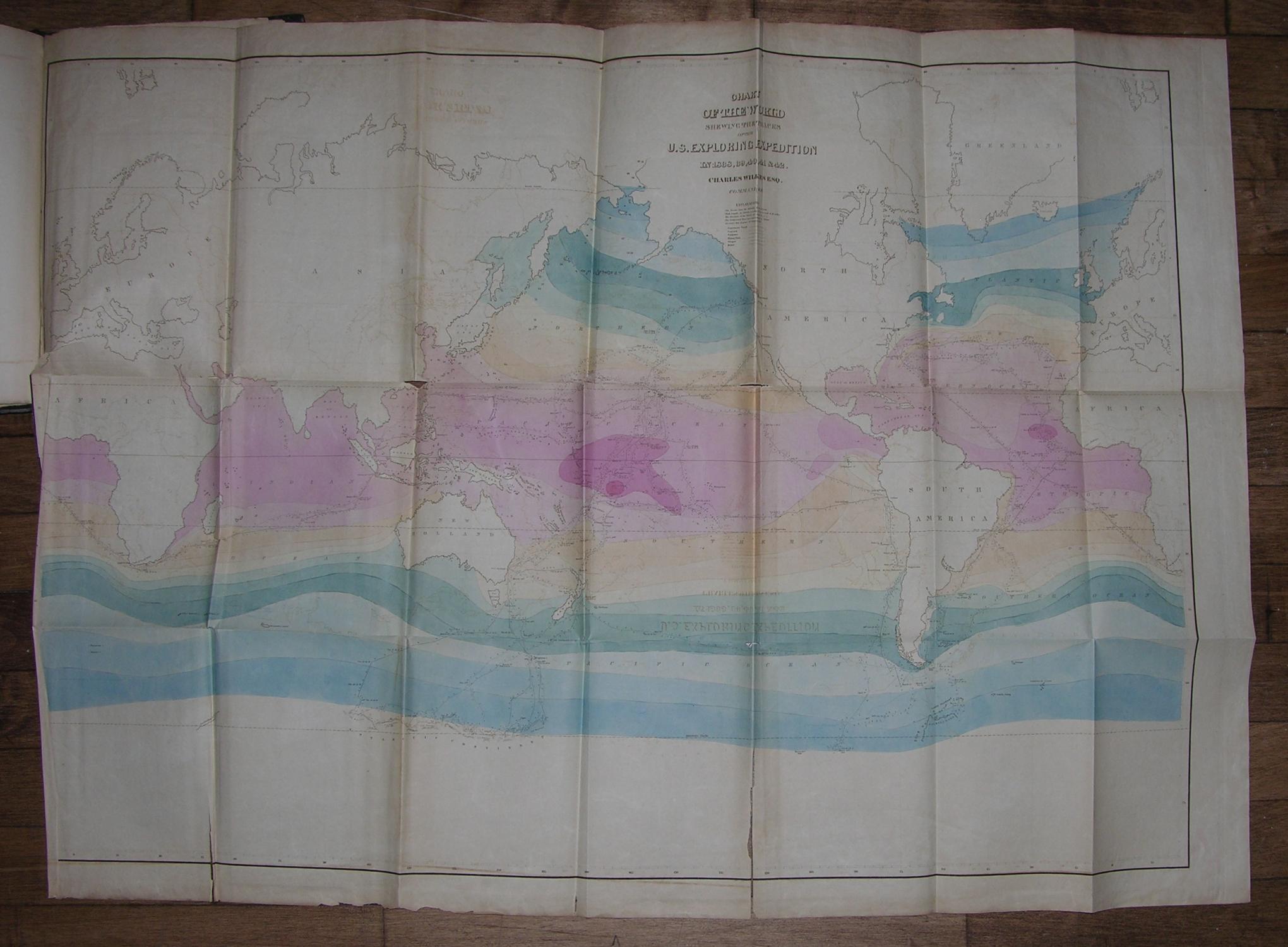
Description: "WILKES, Charles (1798-1877). Atlas to accompany "Narrative of the United States Exploring Expedition. During the years 1838, 1839, 1840, 1841, 1842". Philadelphia: Lea and Blanchard, 1845. Imperial 8vo., (11 x 7 inches). Letterpress title-page, contents leaf. 5 large folding lithographed maps on bank note paper, the "Chart of the World " with contemporary hand-color (few separations at folds, browned, one or two marginal stains). Original brown publisher's cloth, gilt (a bit scuffed at the head and foot of the spine). "THE UNITED STATES EQUIVALENT TO THE VOYAGES OF JAMES COOK, JEAN FRANCOIS GALAUP DE LAPEROUSE, ALEJANDRO MALASPINA, AND IVAN FEDOROVICH KRUZENSHTERN FOR ENGLAND, FRANCE, SPAIN, AND RUSSIA, AND THE MARITIME EQUIVALENT OF LEWIS AND CLARK" (W. Michael Mathes). Atlas to accompany the third issue overall preceded by a very rare quarto edition of about 100 copies (of which 25 were destroyed by fire) published in 1844, and a limited issue of 150 copies for private distribution. This atlas is limited to 1000 copies, see Haskell 16B. These large maps are: "Chart of the World Shewing the Tracks of the U.S. Exploring Expedition in 1838, 39, 40, 41 & 42. Charles Wilkes Esq. Commander", engraved by Sherman & Smith N.Y. A fine map following Mercator's projection, showing winds and currents, the tracks of the ships Vincennes, Peacock, Porpoise, Flying Fish, Oregon, and Relief (tape repairs to verso). "Chart of the Antarctic Continent Shewing the Icy Barrier Attached to it. Discovered by the U.S. Ex. Ex. Charles Wilkes. Esq, Commander 1840" Engraved by Sherman & Smith, N.Y. A fine map with Victoria (Australia) and Van Dieman's Land shaded in, showing the tracks of the ships Vincennes, Peacock, Porpoise, and Flying Fish along the coast of Antarctica, with five profile views of the Antarctic continent (one or two small holes at folds). "Chart of the Viti Group or Feejee Islands by the U.S. Ex. Ex. Charles Wilkes Esq. Commander 1840", engraved by Sherman & Smith, N.Y. A very detailed chart of the islands. "Map of the Oregon Territory by the U.S. Ex. Ex. Charles Wilkes Esqr. Commander. 1841", engraved by J. H. Young & Sherman & Smith, N.Y. A magnificent map (reduced in size for the later editions) with an inset of the "Columbia River Reduced from a Survey Made by the U.S. Ex. Ex. 1841" showing the area of Oregon Territory as claimed by the United States, extending well north of Vancouver, west from the Black Hills, north to just above the fifty-third parallel, and south to Cape Mendocino. This is the "first official [U.S.] chart of any portion of the West Coast and covers the coast from Cape Mendocino to Queen Charlotte Islands. The inset of the Columbia River includes geography extending as far as Walla Walla. It is a handsome map printed on imported paper from copperplates purchased in France from the Depot de la Marine. The engravers themselves were European craftsmen who not only executed the work, but also trained the American apprentices, including the artist James McNeill Whistler, who served as an engraver on the Coast Survey and learned his craft from those who engraved the Wilkes charts" (Cohen, Mapping the West, pp. 120-122). "Map of Part of the Island of Hawaii Sandwich Islands Shewing the Craters and Eruption of May and June 1840. By the U.S. Ex. Ex. 1841", engraved by Sherman & Smith, Sc. N.Y. Showing the area from Hilo to the top of Mauna Loa. Wilke's celebrated circumnavigation explored extensively the coast of South America, the South Seas, Antarctica, California and the Northwest. Departing in August 1838, Wilkes rounded Cape Horn; crossed the Pacific surveying, charting, and exploring the Tuamotus, Tahiti, and Samoa; and reached Sydney, Australia, in November 1839. His ships probed Antarctic waters, cruising 1,500 miles along an unbroken ice shelf; then sailed via New Zealand and Tonga, reaching Fiji in May 1840. In September 1840 Wilkes reached Hawaii, and arrived off the Oregon coast in April 1841, "Wilkes foun
Seller: Arader Galleries - AraderNYC, New York, NY, U.S.A.

Price: US$4500.00 + shipping
Condition: Very Good
Description: 6 volumes. lx+434 pages with frontispiece, 7 plates, 15 vignettes (including music scores), 67 woodcuts, tables and one internal folding map; xvi+476 pages with frontispiece, 13 plates, 14 vignettes (including music scores), 46 woodcuts, and 3 folding maps; xv+438 pages with 12 plates, 10 vignettes (including music scores) and 50 woodcuts; xv+539 pages with fold out frontispiece map, 15 plates, tables, 5 vignettes and 35 woodcuts; xii+558 pages with frontispiece fold out map, 15 plates, 3 vignettes, 49 woodcuts, tables, 3 maps and index; atlas 5 engraved folding maps and charts (one hand-colored) Quarto (10 3/4" x 7") bound in uniform half-blue calf over marbled boards, cornered in calf (Cowan p.683; Forbes 1574; Hill 1867; Haskell 2B, 17; Howes W-414; Rosove 353.B1) The first edition published by Sherman in 1844 of which 100 copies were printed for sale and 63 sets which were given to states and foreign nations and which 25 were destroyed in a fire. An unofficial edition by Lea And Blanchard in 1845 which was the same size and collation except for added half title in Atlas and limited to 150 sets. This the first available edition was limited to 1000 copies. Later octavo editions omitted the Atlas. In 1838, although not yet a seasoned naval line officer, Wilkes was experienced in nautical survey work, and was working with civilian scientists. Upon this background, he was given command of the government exploring expedition ". for the purpose of exploring and surveying the Southern Ocean, . . . as well to determine the existence of all doubtful islands and shoals, as to discover, and accurately fix, the position of those which [lay] in or near the track of our vessels in that quarter, and [might] have escaped the observation of scientific navigators." The U.S. Exploring Squadron was authorized by act of the Congress on May 18, 1836. The United States Exploring Expedition, commonly known as the Wilkes Expedition, included naturalists, botanists, a mineralogist, taxidermists, artists and a philologist, and was carried by the USS Vincennes (780 tons) and Peacock (650 tons), the brig Porpoise (230 tons), the store-ship Relief, and two schooners, Sea Gull (110 tons) and Flying Fish (96 tons). Departing from Hampton Roads on August 18, 1838, the expedition stopped at the Madeira Islands and Rio de Janeiro, Argentina; visited Tierra del Fuego, Chile, Peru, the Tuamotu Archipelago, Samoa, and New South Wales; from Sydney, Australia sailed into the Antarctic Ocean in December 1839 and reported the discovery "of an Antarctic continent west of the Balleny Islands". next, the expedition visited Fiji and the Hawaiian Islands in 1840, explored the west coast of the United States, including the Strait of Juan de Fuca, Puget Sound, the Columbia River, San Francisco Bay and the Sacramento River, in 1841, and returned by way of the Philippines, the Sulu Archipelago, Borneo, Singapore, Polynesia and the Cape of Good Hope, reaching New York on June 10, 1842. In July 1840, two sailors, one of whom was Wilkes' nephew, Midshipman Wilkes Henry, were killed while bartering for food on Fiji's Malolo Island. Wilkes retribution was swift and severe. According to an old man of Malolo Island, nearly 80 Fijians were killed in the incident. From December 1840 to March 1841, he employed hundreds of Hawaiian porters and many of his men to haul a pendulum to the summit of Mauna Loa to measure gravity. Instead of using the existing trail, he blazed his own way, taking much longer than he anticipated. The conditions on the mountain reminded him of Antarctica. Many of his crew suffered snow blindness, altitude sickness and foot injuries from wearing out their shoes. After having completely encircled the globe (his was the last all-sail naval mission to do so), Wilkes had logged some 87,000 miles and lost two ships and 28 men. Wilkes was court-martialed upon his return for the loss of one of his ships on the Columbia River bar, for the regular mistreatment
Seller: The Book Collector, Inc. ABAA, ILAB, Fort Worth, TX, U.S.A.

Price: US$5000.00 + shipping
Description: First trade edition, limited to 1000 copies. 63 (of 64) engraved plates (engraved portrait of Wilkes from later edition laid-in to vol. I, not original to this issue) and 47 steel-engraved vignettes, 14 engraved maps (1 hand-colored), numerous woodcuts. 6 vols. 8vo. A landmark of 19th-century exploration: the voyages led by Wilkes were the most ambitious scientific undertaking to that date and encompassed the Antarctic, the Pacific islands, and the American northwest coast. Extensive exploration of the Antarctic proved impossible due to the state of the ships. Wilkes sailed southwards in 1839 without scientific staff. Despite charting a series of land-falls and appearances of land in the Antarctic, what Wilkes actually saw remains open to conjecture. The scientific work of the expedition was extremely successful. The Smithsonian Institute was founded to house and study the expedition's collections, and the Naval Observatory established to continue the scientific work. Howes W414; Streeter Sale 3324; Tweney 89, 83; Hill 1867; Sabin 103994; Taxonomic Literature 17646; Haskell 2b; Rosove 353.B1; Ferguson 4209; Forbes 1574 Publisher's brown embossed cloth with gilt-stamped vignettes to covers. Spine ends and tips frayed, cloth torn at rear joint of vol. I, plates foxed, 1 plate in vol. I loose, open tear to Oregon Territory map 63 (of 64) engraved plates (engraved portrait of Wilkes from later edition laid-in to vol. I, not original to this issue) and 47 steel-engraved vignettes, 14 engraved maps (1 hand-colored), numerous woodcuts. 6 vols. 8vo First trade edition, limited to 1000 copies.
Seller: James Cummins Bookseller, ABAA, New York, NY, U.S.A.
Price: US$5800.00 + shipping
Description: 5 text volumes and 1 atlas volume. Imperial 8vo., signed in 4's, (11 ½ x 7 ¾ inches). Half titles. 5 fine folding lithographed maps on banknote paper, one with original hand color (some separation along folds, one or two short marginal tears, some browning and offsetting); frontispiece maps in volumes IV and V, 7 double-page engraved maps, engraved frontispieces, 61 engraved plates, numerous in-text illustrations (pale staining to upper margin of a few plates). Original brown publisher's cloth, decorated in blind and lettered in gilt, the smooth spines with gilt vignettes (rebacked to style, preserving most of the original spines, a few pale stains). Provenance: Christie's Sale 1820: The Frank S. Streeter Library: Important Navigation, Pacific Voyages, Cartography, Science; 16 - 17 April 2007. First trade edition. "THE UNITED STATES EQUIVALENT TO THE VOYAGES OF JAMES COOK, JEAN FRANCOIS GALAUP DE LAPEROUSE, ALEJANDRO MALASPINA, AND IVAN FEDOROVICH KRUZENSHTERN FOR ENGLAND, FRANCE, SPAIN, AND RUSSIA, AND THE MARITIME EQUIVALENT OF LEWIS AND CLARK" (W. Michael Mathes). The third overall edition: Haskell's "unofficial issue" 2B, limited to 1,000 copies. Preceded only by the official government edition, published in 1844 and limited to 100 copies, and the unofficial edition, published by Lea and Blanchard in 1845 and limited to 150 copies. The large maps in the atlas are: "Chart of the World Shewing the Tracks of the U.S. Exploring Expedition in 1838, 39, 40, 41 & 42. Charles Wilkes Esq. Commander," engraved by Sherman & Smith N.Y. A fine map following Mercator's projection, showing winds and currents, the tracks of the ships Vincennes, Peacock, Porpoise, Flying Fish, Oregon, and Relief. "Chart of the Antarctic Continent Shewing the Icy Barrier Attached to it. Discovered by the U.S. Ex. Ex. Charles Wilkes. Esq, Commander 1840," engraved by Sherman & Smith, N.Y. A fine map with Victoria (Australia) and Van Dieman's Land shaded in, showing the tracks of the ships Vincennes, Peacock, Porpoise, and Flying Fish along the coast of Antarctica, with five profile views of the Antarctic continent. "Chart of the Viti Group or Feejee Islands by the U.S. Ex. Ex. Charles Wilkes Esq. Commander 1840," engraved by Sherman & Smith, N.Y. A very detailed chart of the islands. "Map of the Oregon Territory by the U.S. Ex. Ex. Charles Wilkes Esqr. Commander. 1841," engraved by J. H. Young & Sherman & Smith, N.Y. A magnificent map (reduced in size for the later editions) with an inset of the "Columbia River Reduced from a Survey Made by the U.S. Ex. Ex. 1841" showing the area of Oregon Territory as claimed by the United States, extending well north of Vancouver, west from the Black Hills, north to just above the fifty-third parallel, and south to Cape Mendocino. This is the "first official [U.S.] chart of any portion of the West Coast and covers the coast from Cape Mendocino to Queen Charlotte Islands. The inset of the Columbia River includes geography extending as far as Walla Walla. It is a handsome map printed on imported paper from copperplates purchased in France from the Depot de la Marine. The engravers themselves were European craftsmen who not only executed the work, but also trained the American apprentices, including the artist James McNeill Whistler, who served as an engraver on the Coast Survey and learned his craft from those who engraved the Wilkes charts" (Cohen, Mapping the West, pp. 120-122). "Map of Part of the Island of Hawaii Sandwich Islands Shewing the Craters and Eruption of May and June 1840. By the U.S. Ex. Ex. 1841," engraved by Sherman & Smith, Sc. N.Y. Showing the area from Hilo to the top of Mauna Loa. Wilke's celebrated circumnavigation explored extensively the coast of South America, the South Seas, Antarctica, California and the Northwest. Departing in August 1838, Wilkes rounded Cape Horn; crossed the Pacific surveying, charting, and exploring the Tuamotus, Tahiti, and Samoa; and reached Sydney, Australia, in November
Seller: Arader Galleries - AraderNYC, New York, NY, U.S.A.
Price: US$5800.00 + shipping
Description: 6 volumes. 5 text volumes. Imperial 8vo., (11 x 7 inches). Half-titles. 5 large folding maps on Japan paper in atlas (1 hand-colored), 9 double-page maps in text volumes, engraved frontispiece portrait of Wilkes, 63 engraved plates, and numerous engravings and vignettes throughout (one or two marginal tears, some spotting throughout). Original brown publisher's cloth, gilt (rubbed and slightly worn). Provenance: With bookplates and ink library stamps of the New Jersey Historical Society. Swann sale 1843, December 1999, Lot 428. First trade edition. "THE UNITED STATES EQUIVALENT TO THE VOYAGES OF JAMES COOK, JEAN FRANCOIS GALAUP DE LAPEROUSE, ALEJANDRO MALASPINA, AND IVAN FEDOROVICH KRUZENSHTERN FOR ENGLAND, FRANCE, SPAIN, AND RUSSIA, AND THE MARITIME EQUIVALENT OF LEWIS AND CLARK" (W. Michael Mathes). The third overall edition: Haskell's "unofficial issue" 2B, limited to 1,000 copies. Preceded only by the official government edition, published in 1844 and limited to 100 copies, and the unofficial edition, published by Lea and Blanchard in 1845 and limited to 150 copies. The large maps in the atlas are: "Chart of the World Shewing the Tracks of the U.S. Exploring Expedition in 1838, 39, 40, 41 & 42. Charles Wilkes Esq. Commander," engraved by Sherman & Smith N.Y. A fine map following Mercator's projection, showing winds and currents, the tracks of the ships Vincennes, Peacock, Porpoise, Flying Fish, Oregon, and Relief. "Chart of the Antarctic Continent Shewing the Icy Barrier Attached to it. Discovered by the U.S. Ex. Ex. Charles Wilkes. Esq, Commander 1840," engraved by Sherman & Smith, N.Y. A fine map with Victoria (Australia) and Van Dieman's Land shaded in, showing the tracks of the ships Vincennes, Peacock, Porpoise, and Flying Fish along the coast of Antarctica, with five profile views of the Antarctic continent. "Chart of the Viti Group or Feejee Islands by the U.S. Ex. Ex. Charles Wilkes Esq. Commander 1840," engraved by Sherman & Smith, N.Y. A very detailed chart of the islands. "Map of the Oregon Territory by the U.S. Ex. Ex. Charles Wilkes Esqr. Commander. 1841," engraved by J. H. Young & Sherman & Smith, N.Y. A magnificent map (reduced in size for the later editions) with an inset of the "Columbia River Reduced from a Survey Made by the U.S. Ex. Ex. 1841" showing the area of Oregon Territory as claimed by the United States, extending well north of Vancouver, west from the Black Hills, north to just above the fifty-third parallel, and south to Cape Mendocino. This is the "first official [U.S.] chart of any portion of the West Coast and covers the coast from Cape Mendocino to Queen Charlotte Islands. The inset of the Columbia River includes geography extending as far as Walla Walla. It is a handsome map printed on imported paper from copperplates purchased in France from the Depot de la Marine. The engravers themselves were European craftsmen who not only executed the work, but also trained the American apprentices, including the artist James McNeill Whistler, who served as an engraver on the Coast Survey and learned his craft from those who engraved the Wilkes charts" (Cohen, Mapping the West, pp. 120-122). "Map of Part of the Island of Hawaii Sandwich Islands Shewing the Craters and Eruption of May and June 1840. By the U.S. Ex. Ex. 1841," engraved by Sherman & Smith, Sc. N.Y. Showing the area from Hilo to the top of Mauna Loa. Wilke's celebrated circumnavigation explored extensively the coast of South America, the South Seas, Antarctica, California and the Northwest. Departing in August 1838, Wilkes rounded Cape Horn; crossed the Pacific surveying, charting, and exploring the Tuamotus, Tahiti, and Samoa; and reached Sydney, Australia, in November 1839. His ships probed Antarctic waters, cruising 1,500 miles along an unbroken ice shelf; then sailed via New Zealand and Tonga, reaching Fiji in May 1840. In September 1840 Wilkes reached Hawaii, and arrived off the Oregon coast in April 1841, "Wilkes found the mouth of
Seller: Arader Galleries - AraderNYC, New York, NY, U.S.A.
Price: US$6500.00 + shipping
Description: Second edition. 6 volumes. 8vo., (11 x 7 inches), including the atlas, in publisher's brown cloth; illustrated with five large folding maps, nine full page maps, and sixty-four full page engravings, one of 1,000 large-paper copies. Provenance: The Estate of David Spinney. Wilke's celebrated circumnavigation explored extensively the coast of South America, the South Seas, Antarctica, California and the Northwest. Departing in August 1838, Wilkes rounded Cape Horn; crossed the Pacific surveying, charting, and exploring the Tuamotus, Tahiti, and Samoa; and reached Sydney, Australia, in November 1839. His ships probed Antarctic waters, cruising 1,500 miles along an unbroken ice shelf; then sailed via New Zealand and Tonga, reaching Fiji in May 1840. In September 1840, Wilkes reached Hawaii, and arrived off the Oregon coast. Later in April 1841, "Wilkes found the mouth of the Columbia a difficult and dangerous harbor. He recommended emphatically in his reports that Puget Sound and the Straits of Juan de Fuca be retained in the ongoing border negotiations between the United States and Britain. In California, describing the potential for a large commercial harbor in San Francisco Bay, he emphasized the lack of Mexican government control of the area. The expedition left San Francisco on 1 November 1841, crossing the Pacific again via Hawaii, Manila, and Singapore to Cape Town. Charting, surveying, and scientific studies were conducted along the route. The voyage ended in New York in June 1842" (Roberta A. Sprague for ANB). For more information on this book, or a warm welcome to see other books and maps of our collection at 72nd Street NYC, please contact Natalie Zadrozna.
Seller: Arader Galleries - AraderNYC, New York, NY, U.S.A.

Price: US$6500.00 + shipping
Description: Five text volumes plus atlas volume. lx,434; xv,476; xv,438; xvi,539; xv,558pp., plus sixty-four engraved plates, nine double-page maps, numerous vignette illustrations. Atlas: five folding maps (one handcolored). Half title in each text volume. Imperial octavo. Original gilt cloth. Cloth worn at corners, spine ends, and along hinges. Early ownership signature on titlepage of each volume. Scattered foxing, occasional offsetting. Minor splits at cross-folds of maps in atlas volume, but with no loss. A very good set. This is the first regularly available trade edition of the narrative of the Wilkes expedition, preceded only by the extremely rare official edition and the further printing of 150 copies made for gifts. The Wilkes Expedition was the first United States scientific expedition by sea, working mainly in the Pacific Ocean. Wilkes sailed along the Antarctic continent and throughout the islands of the South Pacific, visited the Hawaiian Islands in 1840, and explored the northwest coast of America in 1841. The expedition was made up of a number of notable American scientists, and their botanical, natural history, and geological findings are included. The United States Exploring Expedition "was the first American scientific expedition of any size, charged to 'extend the bounds of Science and promote the acquisition of knowledge,' and was one of the most ambitious Pacific expeditions ever attempted" (Forbes). "The chief fields of exploration in this expedition were the coast of the Antarctic continent, the islands of the Pacific Ocean, and the American northwest coast. In total some 280 islands in the Pacific and adjacent waters and 800 miles of streams and coasts in the Oregon country were surveyed, and 1,600 miles of the coast of Antarctica were charted. After leaving Hampton Roads in 1838, the expedition visited Madeira, the Cape Verde Islands, Brazil, Patagonia, the South Shetland Islands, Peter Island, Chile, and Peru, before proceeding to the Tuamotu or the low Archipelago, the Samoa Islands, and New South Wales. From Sydney, Wilkes sailed into the region now known as Wilkesland. He visited Tonga, the Fiji group, and the Hawaiian Islands in 1840, and in 1841 explored the west coast of North America. Much valuable information is given on the Columbia River, the Willamette Valley, Puget Sound, the Strait of Juan de Fuca, and the Sacramento Valley, and the findings on the northwest coast of America proved timely in light of the dispute with Great Britain over the Oregon Territory. The Wilkes expedition also visited San Francisco bay and the Sacramento River. Crossing the Pacific, Wilkes called at the Philippine Islands, the Sulu Archipelago, Borneo, Singapore, and, rounding the Cape of Good Hope, finally reached New York in 1842, having sailed round the world" - Hill. HOWES W414, "aa." STREETER SALE 3324. TWENEY 89, 83. HILL 1867. TAXONOMIC LITERATURE 17646. HASKELL 2B. SABIN 103994. FORBES 1574. ROSOVE ANTARCTIC 353. FERGUSON 4209. COWAN, p.683. REESE, BEST OF THE WEST 85.
Seller: William Reese Company - Americana, New Haven, CT, U.S.A.

Price: US$7609.48 + shipping
Description: Six volumes in five, including the atlas; with 64 steel-engraved plates; text illustrations engraved in steel & wood; nine double-page copper-engraved maps; atlas with five large folding copper-engraved maps & charts (one hand-coloured); contemporary half green pebbled morocco, marbled boards, spines lettered in gilt. The substantial narrative of the massive official American expedition, one of the three great Antarctic voyages of the 1840s. This fine set is an example of the edition of 1000 sets printed of the public edition, which was preceded by the very rare quarto official and unofficial editions, printed in just 100 and 150 copies respectively, many of which were subsequently destroyed, and consequently today almost unknown on the market. Later editions, including the second 1845 octavo edition, are smaller in size, are generally of inferior quality and do not include the fine steel-engravings found here. This is thus the much preferred edition for the collector of voyage or Antarctic material. The explorations of Wilkes along with the English under Ross and the French under Dumont d'Urville form the basis for today's territorial claims in the Antarctic, and together established the knowledge of the frozen continent on which all subsequent expeditions built. While the greatest significance was the expedition into the Antarctic in the winter of 1839-40, with Wilkes being the first to announce the existence of an Antarctic continent, the expedition's other great achievements included the detailed study of the flora and fauna of the many countries visited, the scientists making frequent and long excursions into the interiors. The expedition explored the South Pacific Islands, Australia and New Zealand, the Hawaiian Islands, the Northwest Coast, California, Singapore, the Cape of Good Hope and St. Helena. Two of its most notable achievements were the extensive survey of the American Northwest coast and the exploration of some 1500 miles of the Antarctic coast, "thereby proving the existence of the seventh continent. Equally important, the Expedition collected and described natural history specimens from all parts of the globe â" specimens that eventually came to the fledgling Smithsonian Institution, making it the National Museum of the United States. In a wider sense, the Expedition led to the emergence of the United States as a naval and scientific power with worldwide interests.". ('Magnificent Voyagers. The U.S. Exploring Expedition', ed. H.J. Viola and C. Margolis, Smithsonian Institution, 1985, p.9). .
Seller: Hordern House Rare Books, Surry Hills, NSW, Australia
Price: US$8500.00 + shipping
Description: 5 volumes. 8vo., (9 x 5 4/8 inches). 10 folding maps, one single page map, 3 folding letterpress tables, illustrated throughout with wood-engravings in the text (bound without the 63 engraved plates, some browning). Contemporary half tan calf gilt (extremities scuffed with some minor loss, hinges weak). Provenance: 20th-century gift inscription on front free endpaper of volumes IV and V. Second trade edition, published without an atlas. Wilke's celebrated expedition explored extensively the coast of South America, the South Seas, Antarctica, California and the Northwest, the Philippines and the East Indies. Sabin 103994; Howes W-414. Catalogued by Kate Hunter
Seller: Arader Galleries - AraderNYC, New York, NY, U.S.A.
WILKES Cmdr. Charles. Narrative of the United States Exploring Expedition. , 1845.
Price: US$8645.83 + shipping
Description: During the Years 1838, 1839, 1840, 1841, 1842. First trade edition. 5 vols. plus atlas. 9 double-page maps, 64 engraved plates & 5 large folding maps in the atlas, with numerous illustrations in the text. Tall 8vo. Original pictorial cloth, gilt, a good copy unfaded with the gilt still bright, one or two minor repairs lx, 434; xvi, 476; xvi, 438; xvi, 539; xvi, 558pp. Philadelphia, Lea & Blanchard, With this voyage the United States entered a field of endeavour long dominated by Britain, France and to a lesser extent Russia. This is the narrative for the expedition, a lavishly produced work, but it was supported by several specialist scientific volumes produced by the savants who accompanied the expedition. The Antarctic content of the work is of special significance ?In January and February 1840, sighted the Antarctic continent and followed its coastline for a distance of more than fifteen hundred miles. he was the first to definitely announce the existence of the Antarctic continent? (Lydenberg & Haskell). One thousand copies of this, the first generally available edition were produced. Wilkes commented that ?in some respects as a library and reading book it is to be preferred to the 4to edition? One hundred and fifty copies of which had been produced at the same time. Ferguson, 4209; Haskell, 2b.
Seller: Maggs Bros. Ltd ABA, ILAB, PBFA, BA, London, United Kingdom
Price: US$9000.00 + shipping
Description: 6 volumes. 5 text volumes. Imperial 8vo., (11 x 7 inches). Half-titles. Engraved frontispiece portrait of Wilkes, 9 folding maps, 63 engraved plates, and numerous engravings and vignettes throughout (some spotting, lightly browned). Atlas volume (11 x 7 inches). Four (of five) large folding lithographed maps on bank note paper, the "Chart of the World" with contemporary hand-color (lacking "Map of the Oregon Territory", browned, one or two short marginal tears). Original brown publisher's cloth, gilt (some extremities scuffed with minor loss). Provenance: 19th-century ink library stamp of Julius F. Hutawa (fl. 1832-1872), fine American lithographer, on each title-page. "THE UNITED STATES EQUIVALENT TO THE VOYAGES OF JAMES COOK, JEAN FRANCOIS GALAUP DE LAPEROUSE, ALEJANDRO MALASPINA, AND IVAN FEDOROVICH KRUZENSHTERN FOR ENGLAND, FRANCE, SPAIN, AND RUSSIA, AND THE MARITIME EQUIVALENT OF LEWIS AND CLARK" (W. Michael Mathes). The third issue overall, and preceded by a very rare quarto edition of about 100 copies (of which 25 were destroyed by fire) published in 1844, and a limited issue of 150 copies for private distribution. This issue is limited to 1000 copies, see Haskell 16B. With the RARE publisher's prospectus of 8 leaves (six of text) and one plate (soiled and stained). The large maps in the atlas are: "Chart of the World Shewing the Tracks of the U.S. Exploring Expedition in 1838, 39, 40, 41 & 42. Charles Wilkes Esq. Commander", engraved by Sherman & Smith N.Y. A fine map following Mercator's projection, showing winds and currents, the tracks of the ships Vincennes, Peacock, Porpoise, Flying Fish, Oregon, and Relief. "Chart of the Antarctic Continent Shewing the Icy Barrier Attached to it. Discovered by the U.S. Ex. Ex. Charles Wilkes. Esq, Commander 1840" Engraved by Sherman & Smith, N.Y. A fine map with Victoria (Australia) and Van Dieman's Land shaded in, showing the tracks of the ships Vincennes, Peacock, Porpoise, and Flying Fish along the coast of Antarctica, with five profile views of the Antarctic continent. "Chart of the Viti Group or Feejee Islands by the U.S. Ex. Ex. Charles Wilkes Esq. Commander 1840", engraved by Sherman & Smith, N.Y. A very detailed chart of the islands. "Map of Part of the Island of Hawaii Sandwich Islands Shewing the Craters and Eruption of May and June 1840. By the U.S. Ex. Ex. 1841", engraved by Sherman & Smith, Sc. N.Y. Showing the area from Hilo to the top of Mauna Loa. Wilke's celebrated circumnavigation explored extensively the coast of South America, the South Seas, Antarctica, California and the Northwest. Departing in August 1838, Wilkes rounded Cape Horn; crossed the Pacific surveying, charting, and exploring the Tuamotus, Tahiti, and Samoa; and reached Sydney, Australia, in November 1839. His ships probed Antarctic waters, cruising 1,500 miles along an unbroken ice shelf; then sailed via New Zealand and Tonga, reaching Fiji in May 1840. In September 1840 Wilkes reached Hawaii, and arrived off the Oregon coast in April 1841, "Wilkes found the mouth of the Columbia a difficult and dangerous harbor. He recommended emphatically in his reports that Puget Sound and the Straits of Juan de Fuca be retained in the ongoing border negotiations between the United States and Britain. In California, describing the potential for a large commercial harbor in San Francisco Bay, he emphasized the lack of Mexican government control of the area. The expedition left San Francisco on 1 November 1841, crossing the Pacific again via Hawaii, Manila, and Singapore to Cape Town. Charting, surveying, and scientific studies were conducted along the route. The voyage ended in New York in June 1842" (Roberta A. Sprague for ANB). Cowan I, pp. 248-249n. Cowan II, p. 683. Dorothy Sloan High Spots of Texas, the West, Mexico & the Borderlands-Badu House, Llano, Texas-10/26/2007 lot 8. Ferguson, Australia 4209. Forbes, Hawaiian National Bibliography 1573. Hill (II) #1866. Howes W414. Rosove, Antarctica 353. Streeter
Seller: Arader Galleries - AraderNYC, New York, NY, U.S.A.
Price: US$10000.00 + shipping
Condition: Very Good
Description: 26.5 X 17 cm, four blank and three printed pages with blank verso, ENTERED ACCORDING TO THE ACT OF CONGRESS, IN THE YEAR 1844, BY CHARLES WILKES, U. S. N. | IN THE CLERK'S OFFICE OF THE DISTRICT COURT FOR THE DISTRICT OF COLUMBIA. [rule] STEREOTYPED BY J. FAGAN. |PRINTED BY C. SHEMAN. [rule]; CONTENTS. [rule] TRACK MAP. | (COLORED.) | This Map shows the tracks of the vessels of the Exploring Squadron, combined, and acing separately; the direction of the winds;the currents, their direction and velocity;the isothermal lines for every five degrees of temperature, from the point of perpetualcongelation to the Torrid Zone. (See explanation on Map.) | MAP OF THE ARCTIC CONTINENT. | It exhibits the daily tracks of the vessels along the land discovered by the Expedition,--the winds, currents, temperature, lines of variation, and icy barrierby which it is bounded. MAP OF THE FEEJEE GROUP. | this Map embracesthe Viti or Fejee Group, consusting of one hundred and fifty-four islands, with numerous coral reefs, &c MAP OF THE OREGON GROUP. | Thos embraces the United States possessions west of the Rocky Mountains, betweenparallels 42 and 54 40' N., and also shows Fremont's Pass through the Rocky Mountains. MAP OF THE SOUTHEAST PORTION OF HAWAII. | This Map exhibits the two remakablevolcanic mountains viited by the Expedition, with their numerouscraters, together with the great eruption of 1840, and the track of the party to and from the crater of Moku-a Loa. Original binding; marbeled boards (worn) and original leather binding with six gilt bands, marbeled front and read end papers PROVENANCE: Book Plate of Mirajah H. Clark "Vola Vita mea" (My life is devoted.) \| FIVE LARGE FOLDING MAPS
Seller: T. W. Palmer Books, Eugene, OR, U.S.A.
Price: US$10000.00 + shipping
Condition: Very Good
Description: 5 Volumes text plus Atlas. large 8vo. pp. lx, 434; xv, 476; xv, 438; xvi, 539; xv, 558; [ff. 2]. with half-titles. 9 double-page engraved maps, 64 engraved plates & 5 large folding maps in the atlas (1 hand-coloured). 2 double-leaf tables in Vol. I. numerous text illus. original blind & gilt-stamped cloth (some fraying & chipping to extremities, some foxing to plates & adjacent leaves). Third (First Octavo) Edition, one of 1,000 copies printed (the first two quarto editions were printed in only 100 and 150 copies respectively). This, the first great naval scientific expedition to be sponsored by the United States, consisted of the flagship Vincennes and five other vessels, and numerous civilian naturalists, botanists, artists and other scientists, in additional to sailors and officers. "The chief fields of exploration were the coast of the Antarctic continent, the islands of the Pacific Ocean, and the American northwest coast. Some 280 islands in the Pacific and adjacent waters and 800 miles of streams and coasts in the Oregon country were surveyed, and 1,600 miles of the coast of Antarctica were laid down. Wilkes Land in Antarctica perpetuates the name of the explorer. Much valuable information is given on the Columbia River, the Willamette Valley, Puget Sound, the Strait of Juan de Fuca, and the Sacramento Valley. A survey of the Pacific whale fisheries was also completed. The Wilkes expedition made port at Madeira, the Cape Verde Islands, Brazil, Patagonia, the South Shetland Islands and Peter I Island, Chile, Peru, the Tuamotu, Society, and Samoan Islands, Australia, [New Zealand], Antarctica, New Zealand, the Tongan, Fijian, and Hawaiian Islands, Oregon Territory, California, the Micronesian Islands, the Philippines an Sulus, Singapore, and other ports in the Far East." (Hill p. 615) Bagnall 6072. Ferguson 4209. Hill p. 325. Howes W-414. Sabin 103994. Smith, American Travellers Abroad, W80. Strathern & Edwards 609n. Streeter VI 3324.
Seller: D & E LAKE LTD. (ABAC/ILAB), Toronto, ON, Canada

Price: US$11000.00 + shipping
Description: Philadelphia: Lea and Blanchard, 1845. Third Edition, first generally obtainable edition. Preceded by the extremely rare official quarto edition of 100 copies (of which sixty-three were given to foreign nations and twenty-five destroyed by fire), and the unofficial edition of the same size limited to 150 copies. The present edition is limited to 1,000 copies, which also includes the atlas which was omitted from later editions. Five small quarto text volumes and atlas (11 1/16 x 7 1/8 inches; 280 x 182 mm). [4, blank], lx, [1]-434, [2, blank]; [6, blank], xv, [1,blank], [1]-476, [6, blank]; [6, blank], xv, [1, blank], [1]-438, [8, blank]; [6, blank], xvi, [1]-539, [7, blank]; [6, blank], xv, [1, blank], [1]-558, [8, blank] pp. With sixty-four engraved plates and 295 inter-textual vignettes and woodcuts and nine double-page engraved maps. Atlas with five folding maps, one of which ('Chart of the World') is hand-colored. Each plate with protective tissue guard. Publisher's full brown cloth, decoratively stamped in blind. Each text volume with a pictorial centerpiece, stamped in gilt. Spines lettered in gilt and each pictorially gilt-stamped. Atlas, lettered in gilt on front board and spine, back board with gilt-stamped pictorial centerpiece. Uncut. A very small amount of intermittent foxing and minor toning. Two previous owner's bookplates on front pastedown of each volume. The 'Chart of the World' map in the atlas with a 3.5 inch closed tear, with no loss. Some of the large maps with a bit of offsetting. Head and tails of spines and board edges with just a bit of rubbing, and spines uniformly sunned. overall a very good set. "Charles Wilkes joined the U.S. Navy in 1818; twenty years later he was appointed to command this first navel exploring expedition to the South Seas. The aims of the expedition were to survey unfamiliar ocean regions and make scientific discoveries. Assigned to this duty were the sloops of war Vincennes and Peacock, the brig Porpoise, the ship Relief, and the tenders Sea Gull and Flying Fish. Aboard these vessels were naturalists, botanists, artists, and others with specialized training in scientific exploration, in addition to officers and sailors. The chief fields of exploration in this expedition were the coast of the Antarctic continent, the islands of the Pacific Ocean, and the American northwest coast. In total, some 280 islands in the Pacific and adjacent waters and 800 miles of streams and coasts in the Oregon country were surveyed, and 1,600 miles of the coast of Antarctica were charted. Wilkes continued his navel career, after some controversy about his claim to have been the first to sight the continent of Antarctica and his severe punishment of some crewmen who had broken into the liquor stores. His disagreeable nature caused him to quarrel with many expedition members, casting a shadow over his leadership. Many years later he fought prominently on the Union side in the Civil War, and in 1861, in command of the San Jacinto, Wilkes initiated the famed Mason and Slidell affair by seizing those Confederate commissioners from a British mail steamer near the Bahamas." (Hill, 1866). Wilkes's Narrative "would also have an impact on some of America's most important and influential writers. James Fenimore Cooper, an old family friend of the Wilkes's, would integrate information from the Narrative into at least two of his sea novels. Herman Melville would purchase his own copy of Wilkes's book, and scholars have found traces of the U.S. Exploring Expedition throughout his masterpiece Moby-Dick. Melville appears to have been most taken with the book's illustrations. For example, his description of Ishmael's Polynesian companion Queequeg has been attributed to an engraving of a tattooed Maori chief in volume two. In an age before the widespread use of photography, the pages of the Narrative provided a visual link with the exotic world of the South Pacific (as well as Antarctica and the Pacific Northwest) that no other American book could match" (Nathaniel Philbrick, The Scientific Legacy of the U.S. Exploring Expedition, part of The United States Exploring Exhibition, 1830-1842, an online exhibition by Smithsonian Institution Libraries (Washington, D.C.: 2004)). Hill. Howes W-414. Sabin 103994. Streeter 3324. HBS 67958. $11,000.
Seller: Heritage Book Shop, ABAA, Beverly Hills, CA, U.S.A.
Price: US$13000.00 + shipping
Description: WILKES, Charles (1798-1877). Narrative of the United States Exploring Expedition. During the years 1838, 1839, 1840, 1841, 1842. Philadelphia: Lea and Blanchard, 1845. 6 volumes. 5 text volumes. Imperial 8vo., (11 x 7 inches). Half-titles. Engraved frontispiece portrait of Wilkes, 9 folding maps, 63 engraved plates, and numerous engravings and vignettes throughout. Atlas volume: (11 x 7 inches). Five large folding lithographic maps, the "Chart of the World." with contemporary hand-color (one or two short marginal tears). Original brown publisher's cloth, gilt (some extremities scuffed with minor loss). Provenance: Bookplate of Irving W. Robbins Jr tipped in between the front endpapers of each volume. "THE UNITED STATES EQUIVALENT TO THE VOYAGES OF JAMES COOK, JEAN FRANCOIS GALAUP DE LAPEROUSE, ALEJANDRO MALASPINA, AND IVAN FEDOROVICH KRUZENSHTERN FOR ENGLAND, FRANCE, SPAIN, AND RUSSIA, AND THE MARITIME EQUIVALENT OF LEWIS AND CLARK" (W. Michael Mathes). The third issue overall, and preceded by a very rare quarto edition of about 100 copies (of which 25 were destroyed by fire) published in 1844, and a limited issue of 150 copies for private distribution. This issue is limited to 1000 copies, see Haskell 16B. The large maps in the atlas are: "Chart of the World Shewing the Tracks of the U.S. Exploring Expedition in 1838, 39, 40, 41 & 42. Charles Wilkes Esq. Commander", engraved by Sherman & Smith N.Y. A fine map following Mercator's projection, showing winds and currents, the tracks of the ships Vincennes, Peacock, Porpoise, Flying Fish, Oregon, and Relief. "Chart of the Antarctic Continent Shewing the Icy Barrier Attached to it. Discovered by the U.S. Ex. Ex. Charles Wilkes. Esq, Commander 1840" Engraved by Sherman & Smith, N.Y. A fine map with Victoria (Australia) and Van Dieman's Land shaded in, showing the tracks of the ships Vincennes, Peacock, Porpoise, and Flying Fish along the coast of Antarctica, with five profile views of the Antarctic continent. "Chart of the Viti Group or Feejee Islands by the U.S. Ex. Ex. Charles Wilkes Esq. Commander 1840", engraved by Sherman & Smith, N.Y. A very detailed chart of the islands. "Map of the Oregon Territory by the U.S. Ex. Ex. Charles Wilkes Esqr. Commander. 1841", engraved by J. H. Young & Sherman & Smith, N.Y. A magnificent map (reduced in size for the later editions) with an inset of the "Columbia River Reduced from a Survey Made by the U.S. Ex. Ex. 1841" showing the area of Oregon Territory as claimed by the United States, extending well north of Vancouver, west from the Black Hills, north to just above the fifty-third parallel, and south to Cape Mendocino. This is the "first official [U.S.] chart of any portion of the West Coast and covers the coast from Cape Mendocino to Queen Charlotte Islands. The inset of the Columbia River includes geography extending as far as Walla Walla. It is a handsome map printed on imported paper from copperplates purchased in France from the Depot de la Marine. The engravers themselves were European craftsmen who not only executed the work, but also trained the American apprentices, including the artist James McNeill Whistler, who served as an engraver on the Coast Survey and learned his craft from those who engraved the Wilkes charts" (Cohen, Mapping the West, pp. 120-122). "Map of Part of the Island of Hawaii Sandwich Islands Shewing the Craters and Eruption of May and June 1840. By the U.S. Ex. Ex. 1841", engraved by Sherman & Smith, Sc. N.Y. Showing the area from Hilo to the top of Mauna Loa. Wilke's celebrated circumnavigation explored extensively the coast of South America, the South Seas, Antarctica, California and the Northwest. Departing in August 1838, Wilkes rounded Cape Horn; crossed the Pacific surveying, charting, and exploring the Tuamotus, Tahiti, and Samoa; and reached Sydney, Australia, in November 1839. His ships probed Antarctic waters, cruising 1,500 miles along an unbroken ice shelf; then sailed via New Zealand and Tonga, reac
Seller: Arader Galleries - AraderNYC, New York, NY, U.S.A.
Price: US$16000.00 + shipping
Description: 5 volumes. 8vo., (9 2/8 x 5 6/8 inches). Half-titles. Engraved frontispiece portrait of Wilkes, 9 folding maps, 63 engraved plates, and numerous engravings and vignettes throughout (some minor spotting). Contemporary tan calf gilt (extremities scuffed with some loss, hinges weak). Provenance: Contemporary ownership inscription of "Burt" on the front free endpaper of each volume; later ownership inscription of D.M. Wilson on front free endpaper of each volume. Second trade edition, published without an Atlas. Wilke's celebrated circumnavigation explored extensively the coast of South America, the South Seas, Antarctica, California and the Northwest. Departing in August 1838, Wilkes rounded Cape Horn; crossed the Pacific surveying, charting, and exploring the Tuamotus, Tahiti, and Samoa; and reached Sydney, Australia, in November 1839. His ships probed Antarctic waters, cruising 1,500 miles along an unbroken ice shelf; then sailed via New Zealand and Tonga, reaching Fiji in May 1840. In September 1840 Wilkes reached Hawaii, and arrived off the Oregon coast in April 1841, "Wilkes found the mouth of the Columbia a difficult and dangerous harbor. He recommended emphatically in his reports that Puget Sound and the Straits of Juan de Fuca be retained in the ongoing border negotiations between the United States and Britain. In California, describing the potential for a large commercial harbor in San Francisco Bay, he emphasized the lack of Mexican government control of the area. The expedition left San Francisco on 1 November 1841, crossing the Pacific again via Hawaii, Manila, and Singapore to Cape Town. Charting, surveying, and scientific studies were conducted along the route. The voyage ended in New York in June 1842" (Roberta A. Sprague for ANB). Sabin 103994; Howes W-414.
Seller: Arader Galleries - AraderNYC, New York, NY, U.S.A.
Price: US$30000.00 + shipping
Description: Six volumes bound in five, with the atlas bound into the fifth volume. Portrait, sixty- four plates, and nine maps in the text, and five colored folding maps in the sixth (atlas) volume. Numerous vignettes in the text. With four pages of manuscript material and two smaller printed reports laid in. Quarto. Contemporary three-quarter red morocco and cloth boards, gilt tooled, t.e.g. Hinges and boards slightly rubbed and with minor patches of dampstaining on cloth. Small modern bookplates on front pastedowns. Light foxing, light tanning and slight offsetting to atlas maps. A handsome, very good set. First unofficial edition of the formal narrative of the first American naval exploring expedition: one of only 150 copies printed (only 100 of which were for sale) of this issue of this edition, and rare. Altogether 250 copies of the formal narrative were printed, 100 of them ordered by Congress for official presentation and 150 copies (of which this set is one) that Wilkes had printed "for the purpose of presentation to my friends and for sale to those who should desire a book of that size." Ultimately, Wilkes retained for presentation twenty-five copies; a further twenty-five were used to replace copies of the "official" issue destroyed by fire; the remainder were available for sale. Haskell, the bibliographer of the Wilkes expedition, notes an advertisement for copies of this issue that appeared in one of the subsequent editions, noting that "the Publishers have for sale for Sixty Dollars, in cloth, a few copies of the edition in large Quarto, printed for distribution by Order of Congress. Only one hundred and twenty-five of the two hundred and fifty copies printed have been offered to the public." Accordingly, it is very rare today, while the original official issue (almost exclusively used for presentation to states and to foreign governments) is virtually never seen on the market: "virtually all copies are in institutional libraries" (Rosove). This unofficial issue differs from the official issue in only a couple minor points: here the half title does not have the third line, "By authority of Congress"; and the verso of the titlepage adds the imprint of "C. Sherman, Printer," with his Philadelphia address. The titlepages are dated 1845, while the official version, although not issued until 1845, was dated 1844. The importance of the Wilkes Expedition, the first United States scientific expedition by sea, cannot be overstated. Wilkes' six ships ranged from Tierra del Fuego, Chile, and Peru, to Samoa, Fiji, Tahiti, Hawaii, Australia, New Zealand, the Philippines, and Singapore. Two of the expedition's most notable achievements were the extensive survey of the American northwest coast and the exploration of some 1,500 miles of the Antarctic coast, "thereby proving the existence of the seventh continent. Equally important, the Expedition collected and described natural history specimens from all parts of the globe - specimens that eventually came to the fledgling Smithsonian Institution, making it the National Museum of the United States. In a wider sense, the Expedition led to the emergence of the United States as a naval and scientific power with worldwide interests" (MAGNIFICENT VOYAGERS, p.9). HILL 1866 (ref). HOWES W414, "b." HASKELL 2A. ROSOVE 353.A2. SPENCE 1262. TWENEY, WASHINGTON 83. REESE, BEST OF THE WEST 85.
Seller: William Reese Company - Americana, New Haven, CT, U.S.A.

Price: US$32500.00 + shipping
Description: Philadelphia: Lea & Blanchard, 1845 (last two volumes). Five text volumes, with the five folding maps (two colored) called for in the atlas volume bound into the fourth text volume. Engraved portraits, plates, and maps, with original tissue guards intact. Thick quarto. Contemporary green morocco stamped in gilt, expertly rebacked with original richly gilt backstrips preserved (except second volume, which is rebacked in matching style), gilt inner dentelles, a.e.g. Slight offsetting on the large folding maps, several neatly repaired along folds. Very good set. One of the great rarities of Pacific voyages, here in a mixed set of the true first edition and the first quarto edition of the narrative of the first great scientific expedition sponsored by the government of the United States. The first three volumes of the present set consist of the special Sherman edition of 100 copies, which is the true first edition and was issued for private distribution. The final two volumes are of the Lea and Blanchard printing, which was limited to 150 copies and was preceded only by the Sherman edition. The Lea and Blanchard edition is on the same format as the Sherman edition, and differs only in the preliminary material. The United States Exploring Expedition circumnavigated the globe under the command of Charles Wilkes between the summer of 1838 and the summer of 1842 (for a detailed account of the voyage, see the sources cited below). In July 1842, almost immediately upon his return, Wilkes began work on the narrative, drawing on all of the data and logs assembled by the members of the expedition. This took two years, but by August 1844 the first volume was in the press, and the whole set was ready for binding by the end of the year. The first "Sherman edition," in large quarto format, consisted of only 100 copies for the use of the government, and is easily distinguished by the Sherman imprint of 1844. The "Lea and Blanchard" quarto edition soon followed, and was probably off the presses before the end of 1844 (even though the volumes carry an imprint dated 1845). In fact, the verso of the titlepage of the two Lea and Blanchard volumes notes that the text was in fact printed by Sherman. Both the Sherman and the Lea and Blanchard editions present the text in five volumes, accompanied by an atlas volume of five maps. Those maps are here bound into the front of the fourth text volume. Of the 100 copies printed of the Sherman edition, twenty-five were later destroyed in the Lea and Blanchard fire, sixty-three copies were distributed to foreign governments and federal or state libraries in the United States, and only three were distributed to private individuals. Haskell, in preparing his bibliography of the publications of the expedition, was able to locate over thirty sets in libraries in the United States, but the Sherman edition virtually never appears on the market. The only sets we know of on the market since the 1980s are one from the Carlsmith collection, acquired from Howell, sold in 1985, and now in an Australian library, and two other sets sold by our firm. Of the 150 copies printed of the Lea and Blanchard edition, twenty-five were reserved for private distribution by Wilkes, and the remaining copies were offered for sale to individuals at sixty dollars per set. Haskell was able to locate only seven sets in libraries in the United States. A prime opportunity to obtain a set consisting of the two rarest printings of the most important American naval expedition of the 19th century. HASKELL, UNITED STATES EXPLORING EXPEDITION 1, 2A, 17A. HOWES W414, "c." David B. Tyler, THE WILKES EXPEDITION (Philadelphia, 1968). Herman J. Viola, ed., MAGNIFICENT VOYAGERS, THE U.S. EXPLORING EXPEDITION, 1838-1842 (Washington, 1985). HILL 1866. SABIN 103994. TWENEY, WASHINGTON 83. FORBES 1517. REESE, BEST OF THE WEST 85.
Seller: William Reese Company - Americana, New Haven, CT, U.S.A.