Available Copies from Independent Booksellers
Price: US$2000.00 + shipping
Condition: Near Fine
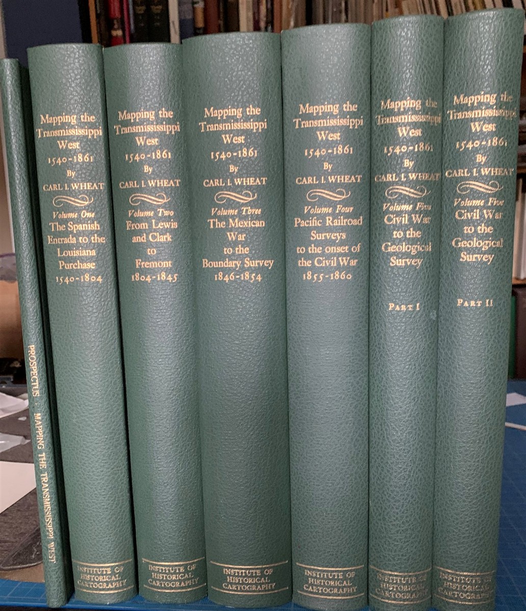
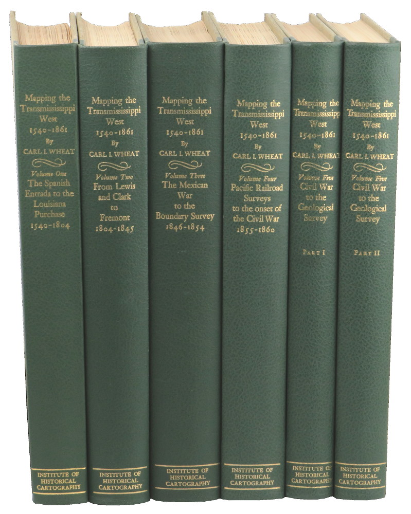
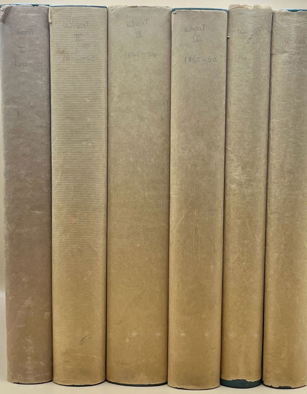
Description: Volumes 1-4 with light offset tanning from plain brown paper jackets that the volumes were originally issued with. ; In an addition of 1000 copies, designed by the Grabhorn Press. Green cloth backs, lettered in gilt and linen over boards; over 300 reproductions of historical maps, many folding. Without the plain paper jackets. The Prospectus Volume bound the same , contains 8 printed leaves, reproducing title pages for volumes 2 through 5, along with descriptions of the project, and reviews. This followed by 7 blank leaves. There are two 8 page printed announcements, one inserted at first title page, the other laid in ; Folio 13" - 23" tall; Volume One, The Spanish Entrada to the Louisiana Purchase, 1540-1804; Volume Two, From Lewis and Clark to Fremont, 1804-1845; Volume Three, From the Mexican War to the Boundary Surveys 1846-1854; Volume Four, From the Pacific Railroad Surveys to the Onset of the Civil War, 1855-1860; Volume Five, Part One, From the Civil War to the Geological Survey; Volume Five, Part Two, From the Civil War to the Geological Survey
Seller: G.F. Wilkinson Books, member IOBA, GRASS VALLEY, CA, U.S.A.
Wheat, Carl I.. Mapping the Transmississippi West. Institute of Historical Cartography, SF, 1957.
Price: US$2000.00 + shipping
Condition: Very Good
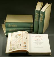
Description: Hardcover. First Edition. 1000cc designed by the Grabhorn Press. xiv, 254pp+ index; xiii, 271pp+ index; xiii, 338pp+ index; xiii, 249pp+ index; xviii, 222pp; 223-442pp+ index. Five volumes in six, illustrated throughout with facsimile maps, many of which are folding; color frontispieces. 14x10", A very good set bound in publisher's green cloth-backed beige cloth, spines lettered in gilt. An essential, monumental and exceptionally thorough work detailing the cartography of the American west from Coronado's "entrada" in 1540 through the U.S. Geological Survey in 1884. Volume one: The Spanish Entrada to the Louisiana Purchase; Volume two: From Lewis and Clark to Fremont 1804-1845; Volume three: The Mexican War to the Boundary Survey 1846-1854; Volume four: Pacific Railroad Surveys to the Onset of the Civil War 1855-1860; Volume five parts one and two: Civil War to the Geological Survey.
Seller: Kenneth Mallory Bookseller ABAA, Decatur, GA, U.S.A.
Price: US$2500.00 + shipping
Description: Five volumes in six (Volume Five in two parts). Folio [36.5 cm.] 1/4 green publisher's buckram over tan cloth boards. Titles gilt on backstrips. All volumes in fine in the original plain brown shipping dust jackets. Tasteful bookplate on the front pastedown of all volumes. This is the nicest set of this landmark work that we have handled. Extra charges apply on this item due to weight. The definitive work on American cartography, with hundreds of maps (some folding) and corresponding in-depth descriptions. Volume One designed and printed by the Grabhorn press. The remaining volumes printed by Taylor and Taylor in the same style as Volume One. A must for any collector of Western Exploration. The importance of this to collectors and cartographers can not be overstated. Volume One: The Spanish Entrada to the Louisiana Purchase, 1540-1804 (264 pp.) Volume Two: From Lewis and Clark to Fremont, 1804-1845 (281 pp.) Volume Three: From the Mexican War to the Boundary Surveys, 1846-1854 (349 pp). Volume Four: From the Pacific Railroad Surveys to the Onset of the Civil War, 1855-1860 (260 pp.). Volume Five: From the Civil War to the Geological Survey (222, 223-487 pp.).
Seller: Ken Sanders Rare Books, ABAA, Salt Lake City, UT, U.S.A.
Price: US$3250.00 + shipping
Condition: Near Fine
Description: 5 volumes in 6. Volume One: The Spanish Entrada to the Louisiana Purchase 1540-1804 xiv+264 pages with color frontispiece map and 275 maps (many folding) and index; Volume Two: From Lewis and Clark to Fremont 1804-1845 xiii+281 pages with colored frontispiece map, 143 additional maps (some folding) and index. Volume Three: From the Mexican War to the Boundary Surveys 1846-1854 xiii+349 pages with colored frontispiece map, 322 additional maps and index; Volume Four: From the Pacific Railroad Surveys to the Onset of the Civil War 1855-1860 xiii+260 pages with color frontispiece map, an additional 127 maps (some folding) and index; Volume Five From the Civil War to the Geological Survey, Part One: xviii+222 pages with color frontispiece map and an additional 152 maps; Volume Five From the Civil War to the Geological Survey, Part Two: [223]-487 pages with 124 maps and index. Folio (14 1/2" x 10 1/2") bound in quarter green leather with gilt lettering to spines. volume I printed by the Grabhorn Press; volumes II-V printed by Taylor & Taylor and James Printing based on the designs of Edwin and Robert Grabhorn. First edition limited to 1000 copies. Carl Wheat's Mapping of the Trans-Mississippi West is a comprehensive and readable cartographic history of the American West. The first three volumes of the work are by necessity bulky and out sized to accommodate the many maps contained with their covers. These beautifully printed books present a truly graphic picture of the exploration and peopling of the vast unknown land west of the Mississippi. The author does not merely present a catalog of significant maps of each era but tells the exciting story of many facets of history that resulted in their making-of the hard journeys, the hazardous exploits, the motivation, the mysticism, the misunderstandings and the strange blend of fact, imagination, false geographic concept and political necessity which were consummated in the engraver's work. These volumes will provide exciting text for the casual reader and have become eminent source book for the student and scholar. Condition: A near fine set.
Seller: The Book Collector, Inc. ABAA, ILAB, Fort Worth, TX, U.S.A.

Price: US$3250.00 + shipping
Description: First Editions. Folio. Limited to 1000 sets. 5 Volumes in 6. xiv, 264pp.; xiii, 281pp.; xiii, 349pp., xiii, 260pp.; xviii, 487pp. Facsimilies of numerous maps, some color, some folded. Green levant-textured quarter buckram with sage buckram cover. Titles in gilt on spine. Fore-edge and tail left untrimmed. The series was designed by the Grabhorn Press and the first volume was printed by them. Volumes two, three, and four were produced by Taylor & Taylor, and Volume five by James Printing Company, all of San Francisco. The type for all volumes was set by Mackenzie & Harris, Inc. This five-volume work describes the maps of Western America from the earliest cartographic conjectures to Spanish explorations of the fifteenth century, through early exploration and overland travel up to the beginnings of the great surveys and the Civil War. Dale Morgan's contribution to this classic work was greater than is generally recognized. From the forewords to the individual volumes it seems that Morgan functioned as an unofficial editor and research fellow. Wheat gratefully acknowledged Morgan's liberal contributions of information, footnotes, and editorial work. Of the text itself, Chapter 36 on Mormon maps in the fourth volume, and all of volume five (two books) was Morgan's work. Additionally, because Wheat was victimized by several strokes, about half of the second volume and ninety percent of the third is attributed to Morgan, though he claimed only the complete volume five in his own bibliography in the Morgan papers. A very fine set. All volumes have the original plain, brown paper dust jackets in very fine condition. No off-setting of dust jackets on endpapers. Volumes Four and Five (1) are signed by Wheat in a very shaky hand. Wheat's small bookplates are lightly affixed to the front endpapers in each volume. Laid-in are the original announcement and prospectus for Volume One and Volume Five. Also laid-in are 2 handwritten letters from Wheat's wife, Helen Millspaugh Wheat, to the previous owner of this set discussing purchase of volumes, signature requests, and Carl Wheat's health resulting from his stroke. Lastly, we include a copy of MAPPING THE TRANSMISSISSIPPI WEST,1540-1861: AN INDEX TO THE CARTOBIBLIOGRAPHY, by Charles A. Seavey, issued as Occassional Paper No.3, by the Map and Geography Round Table of the American Library Association, in 1992.a highly desirable supplement.
Seller: BUCKINGHAM BOOKS, ABAA, ILAB, IOBA, GREENCASTLE, PA, U.S.A.

Price: US$4025.00 + shipping
Description: Illustr, 14.5 x 10, tan cloth w/ green leather spines and gilt lettering, brown paper protective covers, 264, 281, 349, 260, 222, 487 pp. Slight bumping near spine on volume three, all have offsetting to endpapers from covers else fine. FIRST ED, LIMITED TO 1000 COPIES. COMES WITH: Seavey, Charles A. MAPPING THE TRANSMISSISSIPPI WEST, 1540-1861: AN INDEX TO CARTOBIBLIOGRAPHY. Occasional Paper No. 3. Map and Geography Round Table of the American Library Association, Speculum Orbis Press: Winnetka, Illinois 1992. 9.25 x 6.25, blue cloth w/gilt lettering, 210 pp. Light bumping to upper spine tip, faint scratch on front cover else a very good/fine. FIRST ED. Seven volumes total, sold as a set only.
Seller: John K King Used & Rare Books, Detroit, MI, U.S.A.