Available Copies from Independent Booksellers

Price: US$450.00 + shipping
Condition: Good
Description: Volume Two Only. Octavo hardbound, full leather. Spine and boards worn, cracked, chipped, rubbing, corners bumped, front hinge starting but attached. previous owner's name penciled on paste down, foxing throughout. Captain George Vancouver, British Royal Navy officer, best know for his expedition charting North America's northwestern Pacific Coast regions. "He put the northwest coast on the map.He drew up a map of the north-west coast that was accurate to the 9th degeee, to the point it was still being used into the modern day as a navigation aid. That's unsual for a map from that early in time." (Robin Fisher, Mount Royal University).
Seller: COLLINS BOOKS, Seattle, WA, U.S.A.
Price: US$950.00 + shipping
Condition: Fair
Description: Six volumes complete as issued. Lacking plates and charts. Leather spines and corners with marbled boards. Boards appear to have separated from spines on all or most volumes with plastic tape holding them together. Wear to leather. Interiors of all books except for the missing illustrations are in very good condition. (S3)
Seller: Jeff Jeremias Fine Arts, RMABA, Aurora, CO, U.S.A.
Price: US$4500.00 + shipping
Condition: Near Fine
Description: First octavo edition and second edition overall. Six volumes uniformly bound in recent quarter leather and marbled boards, complete with two large folding maps/charts and 17 folding plates; 2 pages of ads at the end of Volume VI. Occasional light foxing, a couple small splits/tears to maps, else fine. Signature of Alfred Fowler on the front free endpaper of Volume I and the rear pastedown of Volume II. Vancouver sailed by way of the Cape of Good Hope to Australia, then to New Zealand, Hawaii, and the northwest coast of America -- discovering previously unknown geographical features in each locale. In three seasons' work, Vancouver surveyed the coast of California with remarkable accuracy, visited a number of the Spanish settlements in Alta California, investigated the Strait of Juan de Fuca, circumnavigated Vancouver island, and disproved the existence of any passage between the Pacific and Hudson Bay. In all, Vancouver's party sailed about 55,000 miles, in what Hill (1753) calls "one of the most important [voyages] ever made in the interests of geographic knowledge." Howgego I V13; Howes V-23; Sabin 98443.
Seller: Walkabout Books, ABAA, Curtis, WA, U.S.A.
Price: US$5000.00 + shipping
Condition: Good
Description: Leather. All charts and plates present. 'A New Edition, with corrections, illustrated with nineteen views and charts.' Edges of boards and spine are rubbed. Boards of vols 2-5 are detached but contained. Front board of vol 6 is completely detached and back board is detached but contained. Previous owner's bookplate on front end leaf of each vol. Bottom edge of spine is chipped on vols 2 and 5. A few pages in each vol have mild foxing. Outer edges of pages are soiled and tanned.
Seller: Moe's Books, Berkeley, CA, U.S.A.

Price: US$6000.00 + shipping
Condition: Very Good
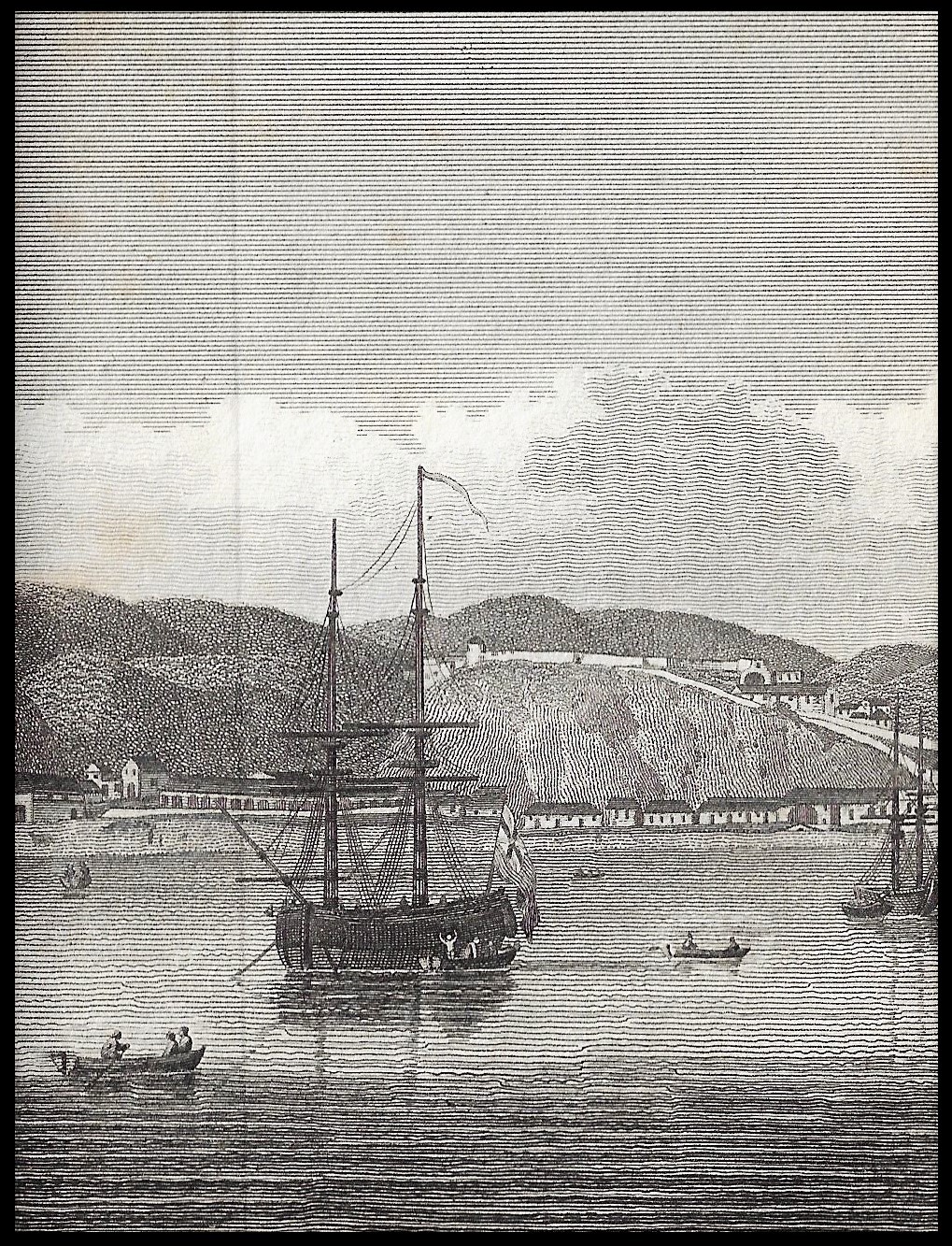
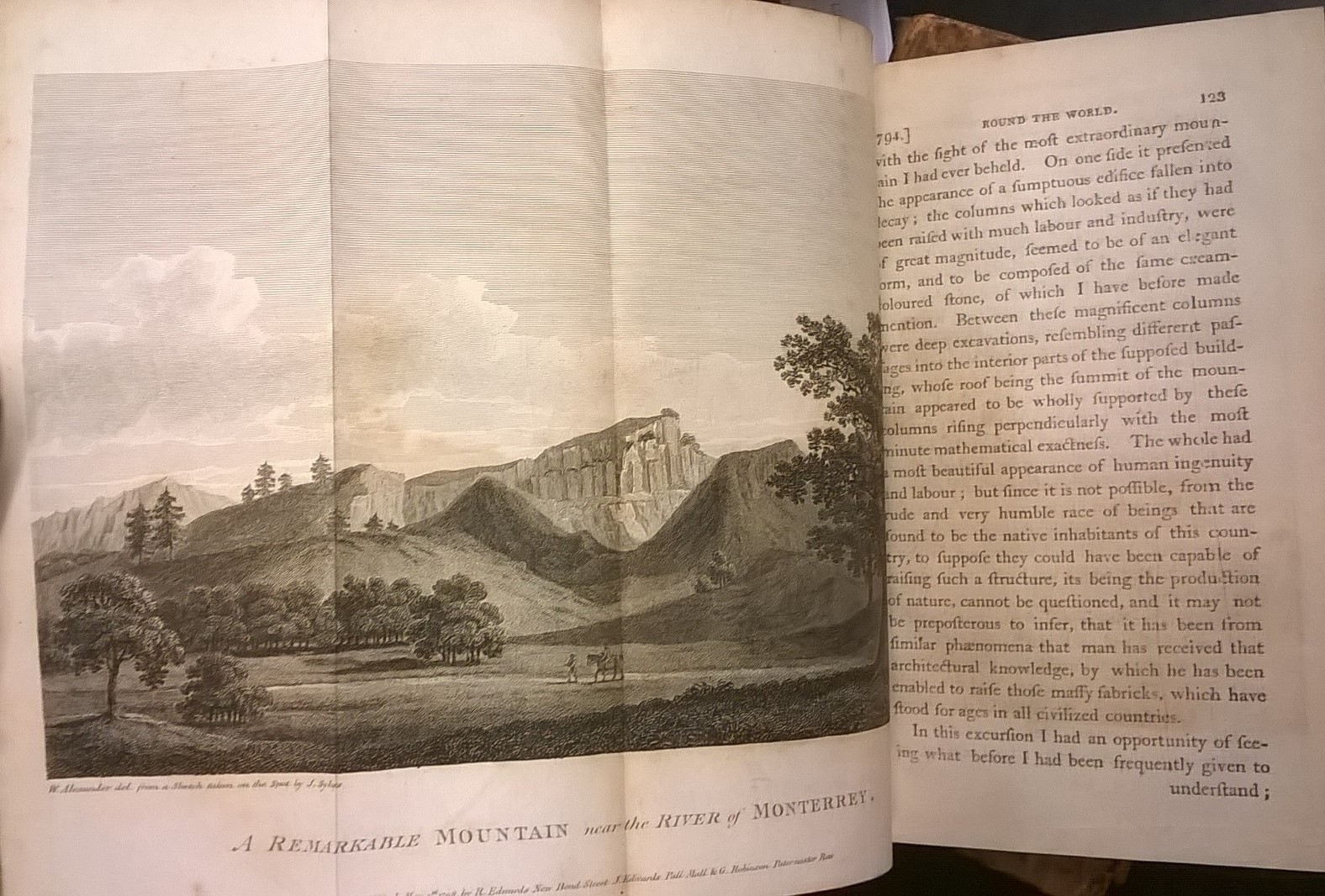
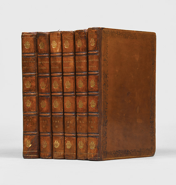
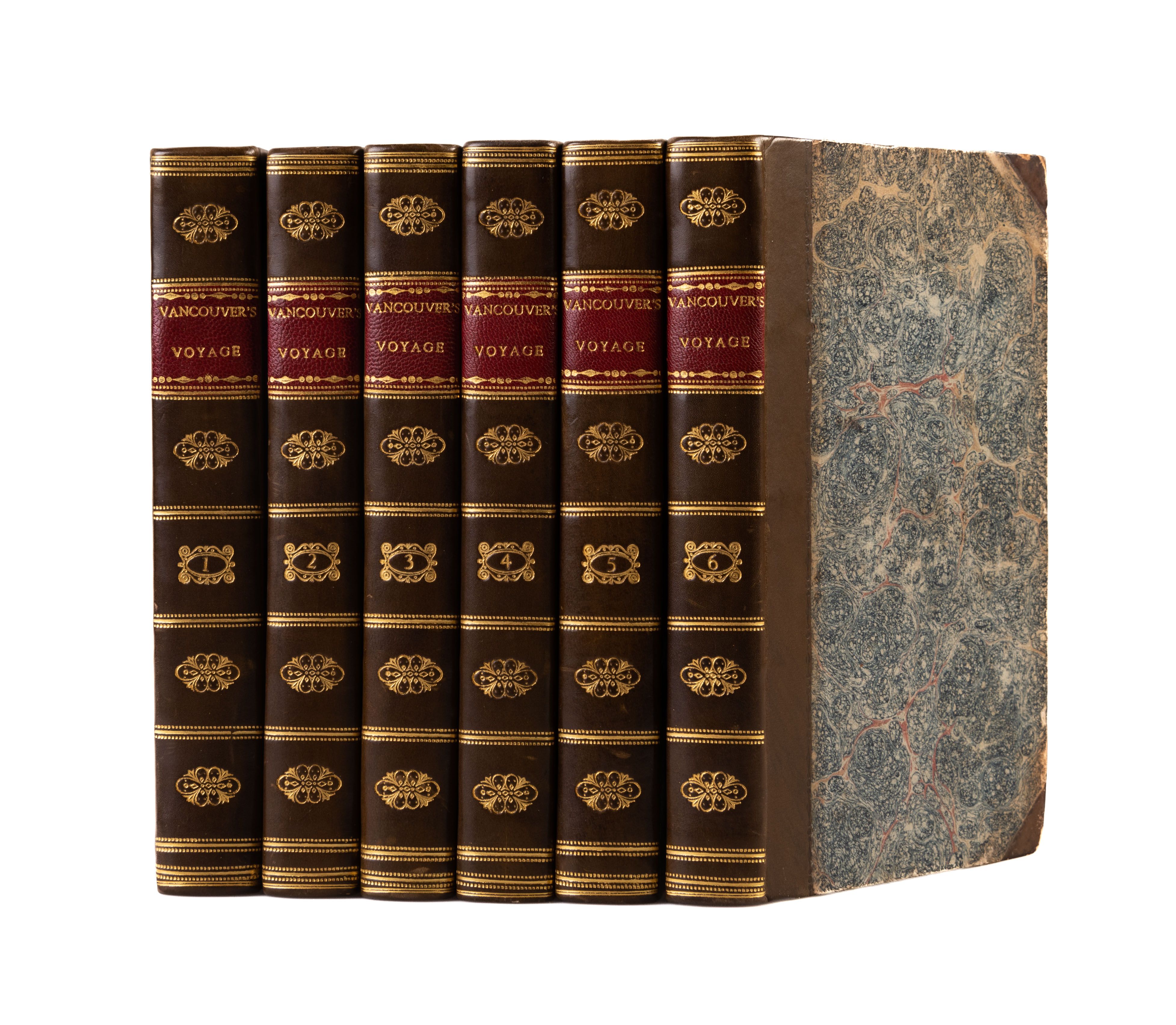
Description: A Voyage of Discovery to the North Pacific Ocean, and Round the World; In Which the Coast of North-west America Has Been Carefully Examined and Accurately Surveyed Undertaken.Principally with a View to Ascertain the Existence of any Navigable Communication Between the North Pacific and North Atlantic Oceans.6 volumes, 8vo (8 1/4 x 5 in.; 21 x 12.7 cm). 2 folding engraved charts, 17 folding engraved plates by Landseer and others after W. Alexander, most from sketches made "on the spot" by Sykes, Heddington, and others. BINDING/CONDITION: Light, occasional toning in all volumes, [Vol. 1]: "Chart of the N.W. Coast of America" detached with small centerfold separation not affecting map, F2-F8 detached, light scattered foxing to the "Chart of the S.W. Coast of New Holland," paper flaw on S1 affecting 3 lines of text, quire Dd partially sprung, hole in Dd8 touching 4 words; [Vol. 2]: title-page and first text leaf detached from text block (but still attached to upper detached board); [Vol. 4]: dark staining along gutter of P8 and Q1-2; [Vol. 6]: lacing publisher's advertisements at the end. Contemporary tree calf, the spine in 6 compartments (2 reserved for red and black morocco lettering pieces, the others stamped gilt with a masted ship motif; spines generally dry with craquelure, [Vol. 1]: rebacked with original spine laid down (short tear to head of spine, minor loss to foot of spine); [Vol. 2]: boards detached, significant loss to spine (one defective label and 4 compartments detached); [Vol. 3]: lower board edge abraded; [Vol. 4]: extremities dry; [Vol. 5]: joints starting; [Vol. 6]: upper board detached, lower hinge reinforced with adhesive tape. (64F8D) FIRST OCTAVO EDITION, THE SECOND AND DEFINITIVE, CORRECTED ENGLISH EDITION. ONE OF THE MOST IMPORTANT ACCOUNTS OF THE EXPLORATION OF THE PACIFIC NORTHWEST AND NEW ZEALAND AND VALUABLE SOURCE INFORMATION ABOUT TAHITI AND THE HAWAIIAN ISLANDS in the last decade of the eighteenth century. Vancouver had sailed with Cook on his second and third voyages (1772-1774 and 1776-1780) and "was made commander of a grand-scale expedition to reclaim Britain's rights, resulting from the Nootka Convention, at Nootka Sound, to examine thoroughly the coast south of 60o in order to find a possible passage to the Atlantic, and to learn what establishments had been founded by other powers. The voyage became one of the most important ever made in the interests of geographical knowledge. Vancouver sailed by way of the Cape of Good Hope to Australia, where he discovered King George's Sound and Cape Hood, then to New Zealand, Hawaii, and the northwest coast of America.[he] surveyed the coast of California, visited San Francisco and San Diego and other Spanish settlements in Alta California. investigated the Strait of Juan de Fuca, discovered the Strait of Georgia, circumnavigated Vancouver Island, and disproved the existence of any passage between the Pacific and Hudson Bay" (Hill). Among the important features of the narrative are the engraved views of the Mission of San Carlos and the Presidio of Monterey, most likely the earliest published views of California. The first edition (1798) comprised three quarto text volumes containing one engraved chart and 17 engraved plates as well as one folio atlas with 10 folding engraved charts and six engraved plates of coastal profiles. After Vancouver's death in May 1798, corrections to the text of the octavo edition were completed by his brother John, assisted by Captain Peter Puget. All 17 plates from the first edition text volumes were reprinted using the original printing plates. There are only two folding charts included in the octavo edition because the printing plates for the chart from the first edition text volumes, along with the charts and plates in the atlas were lost, and the decision was made to re-engrave only two charts. PROVENANCE: Morton Eden, 1st Baron Henley (1752-1830), British diplomat who married the 2nd Earl of Henley's youngest daughte
Seller: Arader Galleries - AraderNYC, New York, NY, U.S.A.
Price: US$6724.53 + shipping
Description: A handsome set of the first octavo edition, first published in quarto in 1798. "This voyage became one of the most important ever made in the interests of geographical knowledge" (Hill); "This is one of the most important voyages for the history and cartography of the northwest coast [of the United States] in general and of Alaska in particular" (Lada-Mocarski). The fourteen-year-old George Vancouver (1758-1798) had accompanied Cook in the Resolution on his second voyage, in the Discovery on his final voyage, and had seen naval warfare with Rodney in the West Indies in 1782. In 1790 it was decided to negotiate the return of Nootka Sound (Vancouver Island, British Columbia) from the Spanish and make an accurate survey of the coast northwards from the 30th degree of north latitude. "As the route was left to his own judgement, he followed Cook's teaching and went westward, touching at the Cape of Good Hope, surveying the south-west coast of Australia, where he discovered and named King George's Sound, Mount Gardner, Cape Hood, and other points in that neighbourhood. Then passing on to New Zealand, he examined the recesses of Dusky Bay, and where Cook had marked on the chart 'Nobody knows what,' he substituted a correct coastline and the name 'Somebody knows what.' He reached Tahiti on 30 Dec. 1791, and in the following year, after the necessary formalities at Nootka, he examined the strait of San Juan de Fuca, discovered the gulf of Georgia, and, passing on, circumnavigated the large island which has since borne his name. The two following years he continued his examination of the coast from San Francisco, northwards, which, for the first time he accurately delineated. In 1795 he returned to England, by Valparaíso, Cape Horn, and St. Helena" (DNB). Vancouver died before he could edit his narrative, which was prepared for the press by his brother John, and Capt. Peter Puget. He has perhaps been overshadowed by the hydrographic brilliance of Cook, but Hill reminds us that "the voyage was remarkable for the accuracy of its surveys, the charts of the coasts surveyed needing little improvement to the present day. When Charles Wilkes resurveyed Puget Sound in 1841, he was amazed at the accuracy Vancouver had achieved under such adverse conditions and despite his failing health. Well into the 1880s Vancouver's charts of the Alaskan coast remained the accepted standard". Forbes 335; Hill 1754; Howes V23; Howgego I V13; Lada-Mocarski 55 (for the first edition); NMM I 142; Sabin 98443; Wickersham 6601. 6 volumes, octavo (208 x 123 mm). Contemporary hand-tooled calf, rebacked to style, sections of the original spines retained and laid down, spines with five low raised bands, titles and three-masted ship devices in gilt within compartments to spines, vine-patterned frame rolled in blind to covers within single gilt rule frame, plain endpapers, board edges rolled in blind, book block edges speckled brown. 2 large folding maps and 17 folding engraved plates by John Landseer, James Heath, James Fittler or Benjamin Thomas Pouncy after William Alexander from sketches made on the spot by John Sykes, Henry Humphrys, Thomas Heddington or Zachary Mudge, all linen backed. Neat contemporary ownership inscription of Henry Lynes to front free endpapers. Inner hinges neatly reinforced with tissue. Slight rubbing and scuffing to boards, touch of wear to tips, occasional light foxing, contents largely clean; an attractive set.
Seller: Peter Harrington. ABA/ ILAB., London, United Kingdom
Price: US$7000.00 + shipping
Condition: Very Good
Description: 6 volumes. 8vo., (8 2/8 x 5 inches). 2-page publisher's advertisment. With 2 folding copper-engraved charts and 17 folding copper-engraved plates engraved by Landseer and others after W. Alexander, most from sketches made "on the spot" by Sykes, Heddington and others (large folding chart of Northwest with tear affecting the Hawaiian inset, other chart with two short tears, a few small nicks at folds, some offsetting, a number with light, mostly marginal dampstaining). Contemporary tree calf (rebacked to style, extremities a bit scuffed, and with a few surface tears). Provenance: with the contemporary engraved armorial bookplate of Harrington Hudson, Bessingby Hall, Bridlington, Yorkshire, on the front paste-down of each volume and with his ownership inscription on the front paste-down of volumes II-VI; with the late 19th-century bookplate of Thomas Walker, the Elms on each front paste-down. First octavo edition. One of the most significant voyages of exploration aimed at the Northwest coast of North America, delineating its bays, rivers and other features with far more accuracy than had hitherto been accomplished. Streeter, describing the first edition of 1798, three quarto volumes with a folio atlas, goes on at some length: "This narrative is one of the most important accounts of the exploration of the Pacific Northwest and New Zealand, and valuable source information about Tahiti and the Hawaiian Islands in the last decade of the eighteenth century. Cowan considered the account to be superior to any of its kind and the chief authority on the areas explored during this period. Vancouver (1758-1798) was an extraordinarily capable explorer, having sailed with Cook on the second and third voyages (1772-4, 1776-80) and served under Rodney and Alan Gardner. It was Gardner who recommended him for a voyage in search for a northwest passage to the Great Lakes. The present narrative is the complete account of that voyage, accompanied by an atlas of maps and views of the areas explored. Vancouver died on May 10, 1798, his brother John completing the task of preparing and editing the narrative. Among the important features of the narrative are the engraved views.of the Mission of San Carlos and the Presidio of Monterey, probably the first published views of California. It is possible that the artist sailing with La Perouse, who visited Monterey in 1786, drew a sketch of the Mission, but no views of California scenery appear in the La Perouse atlas." Howes is of the opinion that "of all modern exploring voyages to the Pacific those of Cook, La Perouse and Vancouver were the most important," and Hill holds out that "This voyage became one of the most important ever made in the interests of geographical knowledge." (Cowan p.654-5); Forbes 335; Hill 1754; Howes V23; Sabin 98441; (Streeter Sale 3497); (Zamorano Eighty 77).
Seller: Arader Galleries - AraderNYC, New York, NY, U.S.A.

Price: US$7105.79 + shipping
Condition: Very Good
Description: 1st Octavo edition. 410; 418; 435; 417; 454; 412; (2)pp. Octavo (14 X 21 cm.) 6 volumes. Bound in 19th century half calf and paper covered boards. All of the board edges have been reinforced with vellum when the binding was done. Volume one has been rebacked to match the rest of the set. Red leather labels. The contents are generally clean with some general soiling throughout. The plates have moderate foxing mainly to the edges. External joints a bit tender on the odd volume but not really a problem. A New edition, with Corrections. Seventeen folding plates and two folding maps with the large folding map housed in a custom slip case to match the rest of the set. The large folding maps has been backed with linen at an early date. The back of the linen has been heavily stained but the front image is good. very good Hill p.304. One of the most important voyages made in the interests of geographical knowledge. Vancouver who had been with Cook on his second and third voyages, was made commander of an expedition to reclaim Britain's rights after the Nootka convention. Sailing by way of Cape of Good Hope, Vancouver made his way to Australia where he discovered King George's Sound and Cape Hood, then to New Zealand, Hawaii, and the northwest coast of America. In three seasons work Vancouver surveyed the coast of California, visited San Francisco and San Diego, settled formalities with the Spanish at Nootka, investigated the Strait of Juan de Fuca, discovered the Strait of Georgia, circumnavigated Vancouver Island, and disproved the existence of any passage between the Pacific and Hudson Bay. The work would be completed by his brother John, assisted by Captain Peter Puget, George having died before the narrative was finished. Bookplate of R. Pilkington on the front paste down of each volume. This second edition like the first has become very scarce and has disappeared from the market.
Seller: Aquila Books(Cameron Treleaven) ABAC, Calgary, AB, Canada
Price: US$7500.00 + shipping
Condition: Very Good
Description: A Voyage of Discovery to the North Pacific Ocean, and Round the World; In Which the Coast of North-west America Has Been Carefully Examined and Accurately Surveyed Undertaken. Principally with a View to Ascertain the Existence of any Navigable Communication Between the North Pacific and North Atlantic Oceans.6 volumes, 8vo (8 1/4 x 5 in.; 21 x 12.7 cm) and one large atlas volume (11 x 8 1/2 in.; 28 x 21.6 cm), 2-page publisher's advertisements at the end of vol. 6; light occasional toning, vol. 5 title-page foxed. 2 engraved folding maps and 17 engraved plates in atlas volume; Chart of the Coast of North America reinforced, scattered foxing to Coast of New Holland, 2 plates trimmed. (64F8D) FIRST OCTAVO EDITION, THE SECOND AND DEFINITIVE, CORRECTED ENGLISH EDITION. ONE OF THE MOST IMPORTANT ACCOUNTS OF THE EXPLORATION OF THE PACIFIC NORTHWEST AND NEW ZEALAND AND VALUABLE SOURCE INFORMATION ABOUT TAHITI AND THE HAWAIIAN ISLANDS in the last decade of the eighteenth century. Vancouver had sailed with Cook on his second and third voyages (1772-1774 and 1776-1780) and "was made commander of a grand-scale expedition to reclaim Britain's rights, resulting from the Nootka Convention, at Nootka Sound, to examine thoroughly the coast south of 60o in order to find a possible passage to the Atlantic, and to learn what establishments had been founded by other powers. The voyage became one of the most important ever made in the interests of geographical knowledge. Vancouver sailed by way of the Cape of Good Hope to Australia, where he discovered King George's Sound and Cape Hood, then to New Zealand, Hawaii, and the northwest coast of America.[he] surveyed the coast of California, visited San Francisco and San Diego and other Spanish settlements in Alta California.investigated the Strait of Juan de Fuca, discovered the Strait of Georgia, circumnavigated Vancouver Island, and disproved the existence of any passage between the Pacific and Hudson Bay" (Hill). Among the important features of the narrative are the engraved views of the Mission of San Carlos and the Presidio of Monterey, most likely the earliest published views of California. The first edition (1798) comprised three quarto text volumes containing one engraved chart and 17 engraved plates as well as one folio atlas with 10 folding engraved charts and six engraved plates of coastal profiles. After Vancouver's death in May 1798, corrections to the text of the octavo edition were completed by his brother John, assisted by Captain Peter Puget. All 17 plates from the first edition text volumes were reprinted using the original printing plates. There are only two folding charts included in the octavo edition because the printing plates for the chart from the first edition text volumes, along with the charts and plates in the atlas were lost, and the decision was made to re-engrave only two charts. REFERENCES: Ferguson, Bibliography of Australia 339; Forbes, Hawaii 1780-1830 I:335; Hill (2004) 1754; Howes V-23; Judd, Voyages to Hawaii before 1860 179; O'Reilly-Reitman, Bibliographie de Tahiti et de la Polynésie française 636; Sabin 98444; Wantrup, Australian Rare Books 63b; Wagner Northwest Coast I, pp. 239-250 PROVENANCE: The Estate of David Spinney (sale, Skinner, 30 October 2016, lot 397)
Seller: Arader Galleries - AraderNYC, New York, NY, U.S.A.

Price: US$8325.61 + shipping
Description: Principally with a View to ascertain the existence of any Navigable Communication between the North Pacific and North Atlantic Oceans; and Performed in the Years 1790, 1791, 1792, 1793, 1794 and 1795, in the Discovery Sloop of War and Armed Tender Chatham, under the Command of Captain George Vancouver. A New Edition with Corrections. SIX VOLUMES. 8vo. 410 [i.e. 406pp, 29-32 omitted in pagination. 418, 435., 417, 454, 412, [2]adverts. [light spotting]. Complete with 2 folding engraved maps & 17 folding plates engraved by Landseer, Pouncy, & Fittler after W. Alexander, from sketches made "on the spot" by Sykes, Heddington, & others. This Voyage became one of the most important ever made in the interests of geographical knowledge" (Hill page 623). Hill 1754; Sabin 98443. Contemporary Polished Tree Calf, gilt border rule, gilt line board edge. raised bands, most attractive original two coloured green-red leather title labels per volume, marbled endpapers, speckled foredges.unrestored [slight wear] FINE SET.
Seller: HALEWOOD : ABA:ILAB : Booksellers :1867, PRESTON, United Kingdom
VANCOUVER George. A Voyage of Discovery to the North Pacific Ocean,. , 1801.
Price: US$8645.83 + shipping
Description: and Round the World, in which the Coast of North-West America has been carefully examined and accurately surveyed. Second edition. 6 vols. Two folding charts and 17 other folding engraved views. 8vo. Contemporary half calf, nicely rebacked, spines richly gilt, with red morocco label to each. 410; [ii], 418; [ii], 435; [ii], 417; [ii], 454; [i], 412, [2]pp. London, John Stockdale, The large engraved map is an entirely new work based on chart 14 in the atlas with three inserts (including the Sandwich Islands) not found in the original version. This map was re-engraved as all the original copper plates for the charts from the first edition atlas had been stolen by the time this edition was published. In 1792, under the orders of George III, Vancouver set out from England to survey the Spanish settlements and coast-line from La Paz in Baja California, to San Francisco, and beyond to the coastline discovered by Cook. His voyage to the northwest coast of America and the hydrographical work completed there rank him as one of Britain's foremost navigators, and Cook's most able protegé. Amongst the ship's companies were Lieut. Zachary Mudge and midshipmen John Sykes,Thomas. Heddington and Henry Humphries and the engraved illustrations made from their his drawings illustrate the work. Those by John Sykes were the first published views of California. Vancouver's impression of the Spanish settlements was of weakness and waste upon the part of the government of Spain. He wrote: ?Why such an extent of territory should have been thus subjugated and after all the expense and labour that has been bestowed upon its colonization turned to no account whatever, is a mystery not easily to be explained.? Sabin, 98443; Forbes, 335; cf Lada-Mocarski, 55.
Seller: Maggs Bros. Ltd ABA, ILAB, PBFA, BA, London, United Kingdom
Price: US$10000.00 + shipping
Condition: Good
Description: 6 Volumes. 8vo. pp. 410 [i.e. 406, pp. 29-32 omitted in pagination; 1 p.l., 418; 1 p.l., 435; 1 p.l., 417; 1 p.l., 454; ` p.l., 412, [2]ads. 2 folding engraved maps & 17 folding plates engraved by Landseer, Pouncy, & Fittler after W. Alexander, from sketches made "on the spot" by Sykes, Heddington, & others. contemporary tree calf, gilt backs, Vol. 1 rebacked with spine mounted, joints of other vols. cracked & some weak, some chipping to spine ends & wear to corners). Second (First Octavo) Edition, of the official account of "the most important [voyage] ever made in the interests of geographical knowledge." (Hill) Vancouver set sail for Nootka Sound on the first of April, 1791, charged by the British government with three tasks: firstly, to take formal possession, according to the terms of the Nootka Sound Convention, of the territory seized there by Spain, secondly, to conduct an accurate survey of the coast northwards from the 30th degree of north latitude, and thirdly, to search for a possible passage to the Atlantic. The expedition took five years to accomplish. Vancouver sailed westward by way of Cape of Good Hope, visited and conducted important surveys of the southwest coast of Australia, New Zealand, Tahiti, and the Sandwich (Hawaiian) Islands before he reached his destination. During the next three seasons, he systematically investigated the Pacific coastline from San Francisco to Cooks Inlet, explored the Straits of Juan de Fuca and Puget Sound, discovered the Gulf of Georgia, and circumnavigated the island since known by his name Vancouver Island. His charts of certain portions of the northwest coast are the eariest and most accurate produced. His researches decisively proved that no passage existed between the Pacific and Hudsons Bay. Cox II 30-31. Ferguson 339. Hill p. 304. Howes V-23. Sabin 98444. Smith 10470. Strathern 582 (i). cfBell V18. cfCowan II 655. cfGraff 4456. cfLada-Mocarski 55. cfLande 1495. cfStreeter VI 3497. cfTPL 688. cfZamorano Eighty 77.
Seller: D & E LAKE LTD. (ABAC/ILAB), Toronto, ON, Canada