Available Copies from Independent Booksellers

Price: US$192.40 + shipping
Condition: Good
Description: Copper engraving of indigenous village on east coast of Vancouver Island, BC. (Kwakiutl/Kwagulth/Kwakwaka wakw) Cheslakee's Village in Johnstone's Straits By J Sykes, J and W Alexander. Alexander visited China in the 1790s, and was later Keeper of Prints and Drawings in the British Museum. From George Vancouver's Voyage, 1791-1795. May 1 1798. Large paper copy, good condition, some foxing. 27x34 cm.
Seller: Joseph Burridge Books, Chadwell Heath, United Kingdom

Price: US$1200.00 + shipping
Description: VANCOUVER, George (1757-1798). Views of Parts of the Coast of North West America. London: R. Edwards, J. Edwards and G. Robinson, May 1st 1798 Single sheet (17 x 22 2/8 inches). Fine engraved plate of coastal profiles, including Punto de los Reyes and the Bay of Sir Francis Drake, Port of St. Francisco, Point Pinos, Santa Barbara, the entrance to the Port of St. Diego, and Cape Colnett. A bright, attractive and important chart from the Atlas volume to Vancouver's "A Voyage of Discovery to the North Pacific Ocean, and Round the World.", London: Printed for G. G. and J. Robinson and J. Edwards, 1798. Vancouver had served on Captain Cook's second and third voyages and "was made commander of a large-scale expedition to reestablish British rights, resulting from the Nootka Convention, at Nootka Sound; to thoroughly examine the coast south of 60 degrees in order to find a possible passage to the Atlantic; and to learn what other establishments had been founded by other powers. This voyage became one of the most important ever made in the interests of geographical knowledge. Vancouver sailed by way of the Cape of Good Hope to Australia, where he discovered King George's Sound and Cape Hood, then to New Zealand, Hawaii, and the northwest coast of America. Vancouver surveyed the coast of California; visited San Francisco, San Diego. and other Spanish settlements in Alta California. investigated the Strait of Juan de Fuca, discovered the Strait of Georgia; circumnavigated Vancouver Island; and disproved the existence of any passage between the Pacific and Hudson Bay" (Hill). "This is one of the most important voyages for the history and the cartography of the northwest coast in general and of Alaska in particular" (Lada-Mocarski). Hill 1753; Howes V23; Lada-Mocarski 55; Lande 1495; NMM 142; Sabin 98443; Staton & Tremaine/TPL 688; Streeter sale VI:3497; Wagner I, pp.239-50.
Seller: Arader Galleries - AraderNYC, New York, NY, U.S.A.
Price: US$1218.54 + shipping
Description: Contemporary old leather covers with faded red morocco title label to the spine. 8vo. 7¼'' x 4½. Contains [xvi] 336 printed pages of text with folding map and three engraved plates. The half-title leaf has a piece of paper pasted across the top and printed T. U. George, below this the name 'Blandford' is by hand. Corners and ends rubbed, front hinge cracked, light age toning to the text block edges. La Pérouse was first published in English in 1785, Maurelle's circa 1780 and Vancouver's work in 1798. The Preface by the Editor is signed with the initial H, but the writer's identity is unknown. Member of the P.B.F.A. AMERICA [History]
Seller: Little Stour Books PBFA Member, Canterbury, United Kingdom
Price: US$1400.00 + shipping
Condition: Good
Description: Volume III only. A good copy, complete with all 6 plates, bound in brown buckram (ex-library with markings from both Library of Congress and the John Crerar Library including Crear ink stamps on the versos of plates and a perforated stamp to title page; some wear to cloth with bumping to corners; some foxing to text and some plates). This celebrated volumes includes both Hawaii and Alaska,
Seller: Arundel Books, Seattle, WA, U.S.A.

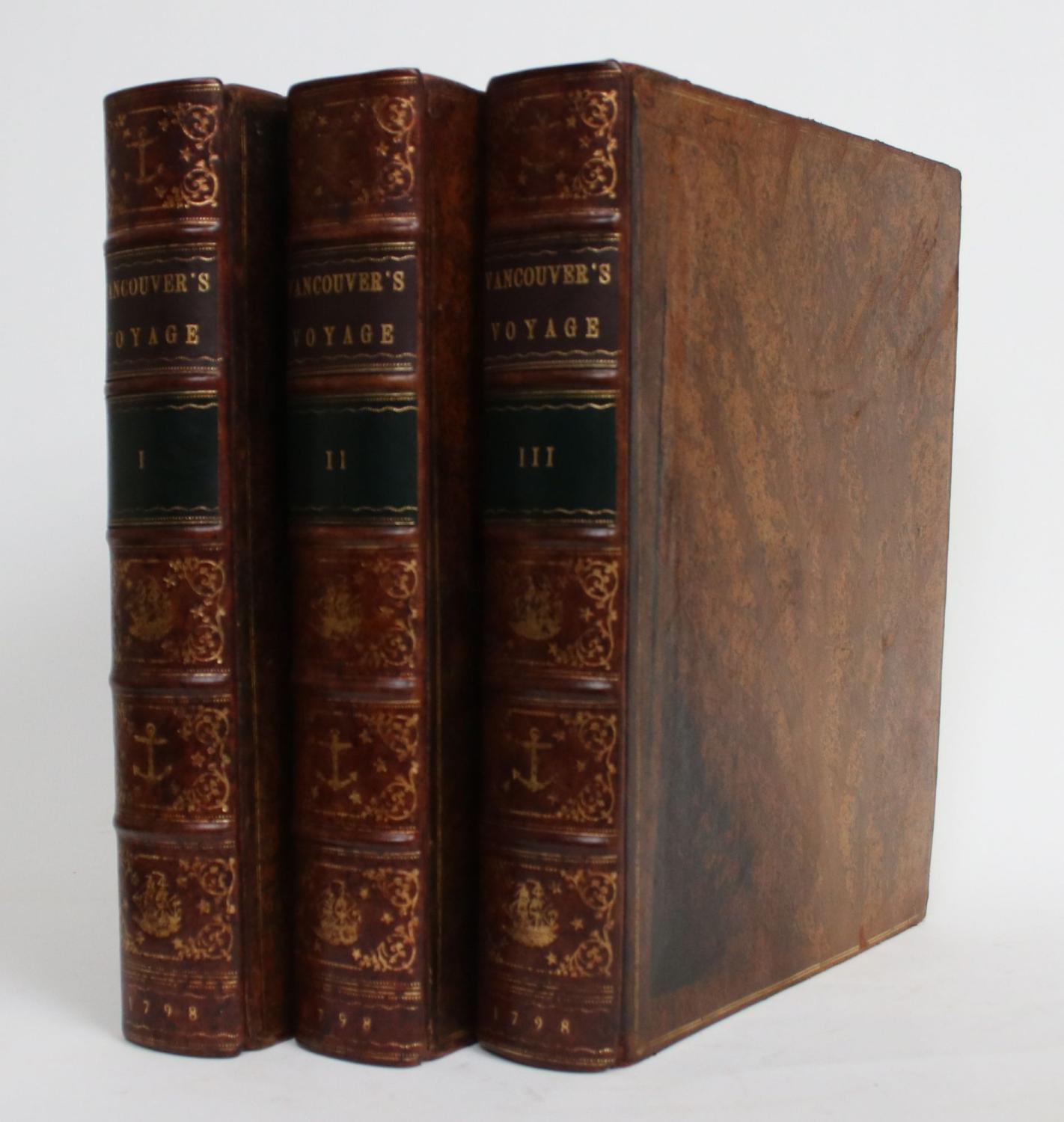
Price: US$4487.40 + shipping
Condition: Very Good
Description: Three Volumes, 4To. Full Calf, Spine Lettered In Gilt On Black Labels. Exterior Edges Decorated In Gilt, Interior Edges In Blind. Half-Title Leaf Present In Volumes One And Three. Marbled End Papers. Eighteen Engraved Plates Present As Called For ( One Is A Map ). The Separate Folio Atlas Volume Is Not Present. Modest Wear To Edges And Joints, Rubbing To Calf On Spines, Upper Hinge Of Volume 2 Cracked But Still Holding. A Sound, Very Good Set. Small Oval Library Stamps ( From Hachette ) On Titles. Some Plates Have Onion Skins Present, Most Plates Show Some Foxing And Offsetting To Adjacent Pages. Bookplates In All Volumes (That In Vol. One Is On The Rear End Paper, Inverted. From The Library Of William C. Merston, Who Built And Lived In The Oak Bay Beach Hotel In Victoria, Bc. The Bookplates Depict A View Of Mount Baker, Through The Window Of His Study In The Hotel.
Seller: Renaissance Books, Victoria, BC, Canada
Price: US$4950.00 + shipping
Condition: Very Good
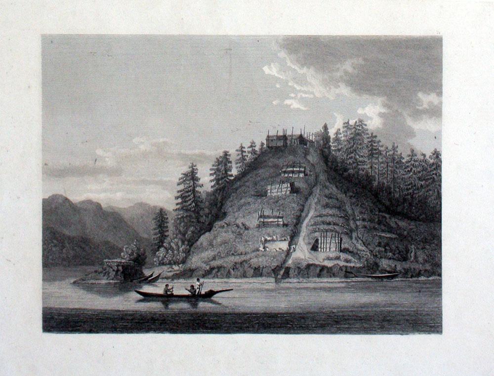
Description: Scarce copper engraved proof plate for a very early image of Canada's British Columbia coast, depicting First Nations people and their village as encountered by Captain George Vancouver. This is a proof for plate IV (Volume I) of George Vancouver's Voyage, 'A Voyage of Discovery to the North Pacific Ocean, and Round the World; in which the Coast of North-west America has been Carefully Examined and Accurately Surveyed .'. Vancouver's voyage was intended to ensure Britain's hold on territory on the Northwest coast of North America, and to search for the Northwest Passage. Vancouver, who began his career sailing under Capt. Cook, explored the mouth of the Columbia River, Vancouver Island, and Puget Sound. There were no commissioned artists on the voyage; Thomas Heddington (1776-1860) was one of four gifted crewmen who made drawings of the new territory. A midshipman on the ship Chatham, Heddington's view shows a tree covered hill with the village at the top, with wooden fish drying structures on the slope, and with First Nation people in canoe on the water. Bute's Canal is now known as Bute's Inlet, about 125 miles from Vancouver on the southwest coast of British Columbia. Vancouver describes the scene depicted here: ". fires of the natives had been observed on entering this canal; which I distinguished by the name of 'Bute's Canal'. Here was found an Indian village, situated on the face of a steep rock, containing about one hundred and fifty of the natives, some few of whom had visited our party on their way up the canal, and now many came off in the most civil and friendly manner, with a plentiful supply of fresh herrings and other fish, which they bartered in a fair and honest way for nails". The drawings were later revised by William Alexander to illustrate Vancouver's Voyage. The original ink and wash sketch for this proof plate sold in Vancouver in 2012 for $55,000 (Heffel Fine Art Auction House, May 17, 2012). The proof plate printed on tissue paper laid on to India paper. Image size 13 1/2 x 10 1/2". Full paper size, 17 1/4 x 12". Two faint diagonal creases upper left side. [with] the printed edition of the print, titled 'Village of the Friendly Indians at the entrance of Bute's Canal'. "W. Alexander del: from a Sketch taken on the Spot by T. Heddington" and "J. Landseer sculp" printed below the image. London, published May 1st 1798 by R. Edwards New Bond Street J. Edwards Pall Mall & G. Robinson Paternoster Row. 11 1/2 x 9 1/4". Both images in very good condition.
Seller: Antipodean Books, Maps & Prints, ABAA, Garrison, NY, U.S.A.
Price: US$5500.00 + shipping
Description: VANCOUVER, George (1757-1798). A chart shewing part of the Coast of N.W. America, with the tracks of His Majesty's Sloop Discovery and armed tender Chatham, Commanded by George Vancouver Esq. and prepared under his immediate inspection by Lieut. Joseph Baker, in Which the Continental Shore has been finally traced and determined from Latd. 38¼15'N. and Longd. 237¼27'E. to Latd. 45¼46'N. and Longd. 236¼15'E. London: J. Edwards and G. Robinson, May 1, 1798 Single sheet (33 x 26 inches). A fine engraved map of the northwest coast of "Part of the Coast of New Albion", showing the area from Bodega Bay, California to Cape Lookout, Oregon, with an inset of the bay of Trinidad lower left (old folds). A bright, attractive and important chart from the Atlas volume to Vancouver's "A Voyage of Discovery to the North Pacific Ocean, and Round the World.", London: Printed for G. G. and J. Robinson and J. Edwards, 1798. Vancouver had served on Captain Cook's second and third voyages and "was made commander of a large-scale expedition to reestablish British rights, resulting from the Nootka Convention, at Nootka Sound; to thoroughly examine the coast south of 60 degrees in order to find a possible passage to the Atlantic; and to learn what other establishments had been founded by other powers. This voyage became one of the most important ever made in the interests of geographical knowledge. Vancouver sailed by way of the Cape of Good Hope to Australia, where he discovered King George's Sound and Cape Hood, then to New Zealand, Hawaii, and the northwest coast of America. Vancouver surveyed the coast of California; visited San Francisco, San Diego. and other Spanish settlements in Alta California. investigated the Strait of Juan de Fuca, discovered the Strait of Georgia; circumnavigated Vancouver Island; and disproved the existence of any passage between the Pacific and Hudson Bay" (Hill). "This is one of the most important voyages for the history and the cartography of the northwest coast in general and of Alaska in particular" (Lada-Mocarski). Hill 1753; Howes V23; Lada-Mocarski 55; Lande 1495; NMM 142; Sabin 98443; Staton & Tremaine/TPL 688; Streeter sale VI:3497; Wagner I, pp.239-50.
Seller: Arader Galleries - AraderNYC, New York, NY, U.S.A.
Price: US$5500.00 + shipping
Description: VANCOUVER, George (1757-1798). A Chart shewing part of the Coast of N.W. America, with the tracks of His Majesty's Sloop Discovery and Armed Tender Chatham; Commanded by George Vancouver Esqr. and prepared under his immediate inspection by Lieut. Joseph Baker, in which the Continental Shore has been traced and determined from Lat. 51¼45'N. and Long. 232¼08' E. to Lat. 57¼30'N and Long 226¼44'E. at the different periods shown by the Tracks. London: J. Edwards and G. Robinson, May 1st 1798. Single sheet (33 x 26 inches). A fine engraved chart of the northwest coast of America from Kings Island, British Columbia in the south to Admiralty Island, Alaska in the north, with an inset of A Survey of Port Stewart lower left (old folds). A bright, attractive and important chart from the Atlas volume to Vancouver's "A Voyage of Discovery to the North Pacific Ocean, and Round the World.", London: Printed for G. G. and J. Robinson and J. Edwards, 1798. Vancouver had served on Captain Cook's second and third voyages and "was made commander of a large-scale expedition to reestablish British rights, resulting from the Nootka Convention, at Nootka Sound; to thoroughly examine the coast south of 60 degrees in order to find a possible passage to the Atlantic; and to learn what other establishments had been founded by other powers. This voyage became one of the most important ever made in the interests of geographical knowledge. Vancouver sailed by way of the Cape of Good Hope to Australia, where he discovered King George's Sound and Cape Hood, then to New Zealand, Hawaii, and the northwest coast of America. Vancouver surveyed the coast of California; visited San Francisco, San Diego. and other Spanish settlements in Alta California. investigated the Strait of Juan de Fuca, discovered the Strait of Georgia; circumnavigated Vancouver Island; and disproved the existence of any passage between the Pacific and Hudson Bay" (Hill). "This is one of the most important voyages for the history and the cartography of the northwest coast in general and of Alaska in particular" (Lada-Mocarski). Hill 1753; Howes V23; Lada-Mocarski 55; Lande 1495; NMM 142; Sabin 98443; Staton & Tremaine/TPL 688; Streeter sale VI:3497; Wagner I, pp.239-50.
Seller: Arader Galleries - AraderNYC, New York, NY, U.S.A.
Price: US$5500.00 + shipping
Description: VANCOUVER, George (1757-1798). A Chart shewing part of the Coast of N.W. America, With the Tracks of His Majesty's Sloop Discovery and Armed Tender Chatham; Commanded by George Vancouver Esqr. and prepared under his immediate inspection by Lieut. Joseph Baker, in which the Continental Shore has been traced and determined from Lat. 30¼00'N. and Long. 244¼32' E. to Lat. 38¼30'N and Long 237¼13'E. London: J. Edwards and G. Robinson, May 1st 1798 Single sheet (33 x 26 inches). A fine engraved chart of the coast of northwest America extending from St. Domingo, Mexico in the south to Point Reyes, California in the north, showing San Francisco Bay and Santa Barbara, with insets of the Entrance of Port St. Francisco and Port St. Diego, lower and center left. Showing the tracks of the voyage and Spanish Missions and Presidios. A bright, attractive and important chart from the Atlas volume to Vancouver's "A Voyage of Discovery to the North Pacific Ocean, and Round the World.", London: Printed for G. G. and J. Robinson and J. Edwards, 1798. Vancouver had served on Captain Cook's second and third voyages and "was made commander of a large-scale expedition to reestablish British rights, resulting from the Nootka Convention, at Nootka Sound; to thoroughly examine the coast south of 60 degrees in order to find a possible passage to the Atlantic; and to learn what other establishments had been founded by other powers. This voyage became one of the most important ever made in the interests of geographical knowledge. Vancouver sailed by way of the Cape of Good Hope to Australia, where he discovered King George's Sound and Cape Hood, then to New Zealand, Hawaii, and the northwest coast of America. Vancouver surveyed the coast of California; visited San Francisco, San Diego. and other Spanish settlements in Alta California. investigated the Strait of Juan de Fuca, discovered the Strait of Georgia; circumnavigated Vancouver Island; and disproved the existence of any passage between the Pacific and Hudson Bay" (Hill). "This is one of the most important voyages for the history and the cartography of the northwest coast in general and of Alaska in particular" (Lada-Mocarski). Hill 1753; Howes V23; Lada-Mocarski 55; Lande 1495; NMM 142; Sabin 98443; Staton & Tremaine/TPL 688; Streeter sale VI:3497; Wagner I, pp.239-50.
Seller: Arader Galleries - AraderNYC, New York, NY, U.S.A.
Price: US$5500.00 + shipping
Description: VANCOUVER, George (1757-1798). A Chart shewing part of the Coast of N.W. America, With the Tracks of His Majesty's Sloop Discovery and Armed Tender Chatham; Commanded by George Vancouver Esqr. and prepared under his immediate inspection by Lieut. Joseph Baker, in which the Continental Shore has been traced and determined from Latde. of 59¼30' North & Longde. 207¼20' East; to Cape Douglas in Latde. 58¼52' North and Longde. 207¼20' East. London: T.R. Edwards & C. Robinson, May 1st 1798. Single sheet (33 x 26 4/8 inches). A fine engraved map of the area around Kodiak Island and the Kenai Peninsula in Alaska, with an inset of 'A Survey of Port Chatham' lower right (old folds). A bright, attractive and important chart from the Atlas volume to Vancouver's "A Voyage of Discovery to the North Pacific Ocean, and Round the World.", London: Printed for G. G. and J. Robinson and J. Edwards, 1798. Vancouver had served on Captain Cook's second and third voyages and "was made commander of a large-scale expedition to reestablish British rights, resulting from the Nootka Convention, at Nootka Sound; to thoroughly examine the coast south of 60 degrees in order to find a possible passage to the Atlantic; and to learn what other establishments had been founded by other powers. This voyage became one of the most important ever made in the interests of geographical knowledge. Vancouver sailed by way of the Cape of Good Hope to Australia, where he discovered King George's Sound and Cape Hood, then to New Zealand, Hawaii, and the northwest coast of America. Vancouver surveyed the coast of California; visited San Francisco, San Diego. and other Spanish settlements in Alta California. investigated the Strait of Juan de Fuca, discovered the Strait of Georgia; circumnavigated Vancouver Island; and disproved the existence of any passage between the Pacific and Hudson Bay" (Hill). "This is one of the most important voyages for the history and the cartography of the northwest coast in general and of Alaska in particular" (Lada-Mocarski). Hill 1753; Howes V23; Lada-Mocarski 55; Lande 1495; NMM 142; Sabin 98443; Staton & Tremaine/TPL 688; Streeter sale VI:3497; Wagner I, pp.239-50.
Seller: Arader Galleries - AraderNYC, New York, NY, U.S.A.
Price: US$5500.00 + shipping
Description: VANCOUVER, George (1757-1798). A Chart Shewing part of the Coast of N.W. America, With the Tracks of His Majesty's Sloop Discovery and Armed Tender Chatham; Commanded by George Vancouver Esqr. and prepared under his immediate inspection by Lieut. Joseph Baker, in which the Continental Shore has been traced and determined from Latd. 59¼45'N. and Longd. 219¼30'E. to Latd. 59¼56'N and Longd. 212¼08'E. at the periods shewn by the Track. London. J. Edwards & G. Robinson, May 1st 1798 Single sheet (26 x 33 inches). A fine engraved map of the northwest coast of America showing Prince William's Sound and surrounding areas in Alaska, with an inset of 'A Survey of Port Chalmers' top right. A bright, attractive and important chart from the Atlas volume to Vancouver's "A Voyage of Discovery to the North Pacific Ocean, and Round the World.", London: Printed for G. G. and J. Robinson and J. Edwards, 1798. Vancouver had served on Captain Cook's second and third voyages and "was made commander of a large-scale expedition to reestablish British rights, resulting from the Nootka Convention, at Nootka Sound; to thoroughly examine the coast south of 60 degrees in order to find a possible passage to the Atlantic; and to learn what other establishments had been founded by other powers. This voyage became one of the most important ever made in the interests of geographical knowledge. Vancouver sailed by way of the Cape of Good Hope to Australia, where he discovered King George's Sound and Cape Hood, then to New Zealand, Hawaii, and the northwest coast of America. Vancouver surveyed the coast of California; visited San Francisco, San Diego. and other Spanish settlements in Alta California. investigated the Strait of Juan de Fuca, discovered the Strait of Georgia; circumnavigated Vancouver Island; and disproved the existence of any passage between the Pacific and Hudson Bay" (Hill). "This is one of the most important voyages for the history and the cartography of the northwest coast in general and of Alaska in particular" (Lada-Mocarski). Hill 1753; Howes V23; Lada-Mocarski 55; Lande 1495; NMM 142; Sabin 98443; Staton & Tremaine/TPL 688; Streeter sale VI:3497; Wagner I, pp.239-50.
Seller: Arader Galleries - AraderNYC, New York, NY, U.S.A.
Price: US$5500.00 + shipping
Description: VANCOUVER, George (1757-1798). A Chart Shewing part of the Coast of N.W. America, With the Tracks of His Majesty's Sloop Discovery and Armed Tender Chatham; Commanded by George Vancouver Esqr. and prepared under his immediate inspection by Lieut. Joseph Baker, in which the Continental Shore has been traced and determined from Latde. 57¼07'1/2N. and Longd. 227¼00'E. to Latd. 59¼39'N and Longd. 219¼00'E. London: J. Edwards & G. Robinson, May 1st 1798. Single sheet (33 x 26 inches). A fine engraved chart showing the area in Alaska around the Alexander Archipelago, with three insets lower left: - Entrance into Cross Sound - A Survey of Port Conclusion - A Survey of Port Protection A bright, attractive and important chart from the Atlas volume to Vancouver's "A Voyage of Discovery to the North Pacific Ocean, and Round the World.", London: Printed for G. G. and J. Robinson and J. Edwards, 1798. Vancouver had served on Captain Cook's second and third voyages and "was made commander of a large-scale expedition to reestablish British rights, resulting from the Nootka Convention, at Nootka Sound; to thoroughly examine the coast south of 60 degrees in order to find a possible passage to the Atlantic; and to learn what other establishments had been founded by other powers. This voyage became one of the most important ever made in the interests of geographical knowledge. Vancouver sailed by way of the Cape of Good Hope to Australia, where he discovered King George's Sound and Cape Hood, then to New Zealand, Hawaii, and the northwest coast of America. Vancouver surveyed the coast of California; visited San Francisco, San Diego. and other Spanish settlements in Alta California. investigated the Strait of Juan de Fuca, discovered the Strait of Georgia; circumnavigated Vancouver Island; and disproved the existence of any passage between the Pacific and Hudson Bay" (Hill). "This is one of the most important voyages for the history and the cartography of the northwest coast in general and of Alaska in particular" (Lada-Mocarski). Hill 1753; Howes V23; Lada-Mocarski 55; Lande 1495; NMM 142; Sabin 98443; Staton & Tremaine/TPL 688; Streeter sale VI:3497; Wagner I, pp.239-50.
Seller: Arader Galleries - AraderNYC, New York, NY, U.S.A.
Price: US$6500.00 + shipping
Condition: Good
Description: 3 volume set; 3/4 quarto leather with marbled boards, in the original binding. Lacking Folio Atlas; Volume 1: 432pp, tight binding, some foxing throughout; 7 plates, Plate VII listed for page 467, found on page 388. Volume 2: 504pp; tight binding, some foxing throughout; 4 plates, lacks chart/map on page 94. Volume 3: 505pp. tight text block, front board nearly detached, some foxing throughout; Lacks half title page of Volume 3, Inner margin of volume 3 title page expertly restored; 6 plates. Good overall condition on this very important set. "Most of the three years occupied was spent on the California and Northwest coasts which were now first accurately charted. Of all modern exploring voyages to the Pacific, those of Cook, La Perouse and Vancouver were the most important" (Howes V23). Zamorano 80: Number 77.
Seller: COLLINS BOOKS, Seattle, WA, U.S.A.

Price: US$8500.00 + shipping
Condition: Fine
Description: VANCOUVER, George (1757-1798) Voyage of Discovery to the North Pacific Ocean, and Round the World. Performed in the Years 1790, 1791, 1792, 1793, 1794, and 1795, in the Discovery Sloop of War, and Armed Tender Chatham "Of All Modern Exploring Voyages to the Pacific those of Cook, La Perouse and Vancouver were the Most Important" (Howes) "Vancouver, who had served on Cook's third voyage, was made commander of an expedition whose express purpose was to reclaim wherever possible British rights to the Northwest Coast of America. Vancouver sailed to the Pacific via Australia, where he discovered and charted King George Sound and Cape Hood, passed Van Deiman's Land, and visited New Zealand, Hawaii and the Northwest Coast. During the course of three seasons, he surveyed Alaska and the Northwest Coast, investigated the Strait of Juan de Fuca, discovered the Strait of Georgia, and circumnavigated Vancouver Island. He visited San Francisco, Monterey, and other Spanish settlements in Alta California ' (Graff ). "His voyage is important not only for the magnificent charts and splendid views that accompanied it, but also for the valuable and extensive amount of information that it provided on the Spanish settlements, the Indian tribes, and the physical features of the countries that he visited. It is one of the 'classics' of late eighteenth-century geographical literature" (Howell). London Printed for G.G. and J. Robinson, and J. Edwards, 1798. First Edition. Three Quarto volumes, lacking folio atlas. Eighteen engraved plates, one of which is a map in the text. Typical uniform toning with some offsetting from boldly struck plates. Complete with half-titles. Text volumes rebound in full tree calf leather binding. Boards lined in double rule and ornamentation. Interior edge and border edge highly decorated in gilt. Spines display 5 raised bands and 6 panels. Exquisite decorative gilt tooling to spine. Decorated red leather title labels and green leather volume labels to spine. Beautiful green marbled end-papers. Fine contemporary binding in style by Richard Smart, Old English Bindery, Vancouver, British Columbia. No Previous owner's bookplate. Plates and text very clean with some very light toning. An excellent set without atlas. Cowan, p. 655. Graff 4456. Hill I, p. 303. Howes V23. Sabin 98443. HBS 64761. Zamorano 80: Number 77 Beautiful Rebound Classic of Northwest Exploration $14,500
Seller: Pacific Coast Books, ABAA,ILAB, Gleneden Beach, OR, U.S.A.
Price: US$9000.00 + shipping
Condition: Very Good
Description: London: G. G. and J. Robinson; and J. Edwards, 1798. 3 voll. (lacking the atlas). First edition. Quarto (11 3/4" x 9 1/4", 300mm x 235mm). With 18 engravings: 17 landscapes and one map. Bound in contemporary calf with a triple gilt fillet border. On the spine, 6 panels. Title gilt to black morocco in the second panel. Volume number to green morocco in the fourth panel. Gilt schooner to the other panels. Gilt roll to the edges of the boards. Gilt inside dentelles with green marbled endpapers. All edges of the text-block marbled. Bookplate of "Edward Everett Ayer and presented by him to The Newberry Library, 1911" to the front paste-down of each volume, with the Newberry de-accession label below. Extremities and hinges worn. Scratches to the front and rear boards. Skinning to the rear board of vol. 3. A little foxing and off-setting around the engravings. The H.M.S. Discovery was commissioned in 1790 with Vancouver in command. He had sailed with Cook on his second and third voyages (1772-1774 and 1776-1780) and was made commander of a grand-scale expedition to reclaim Britain's rights, resulting from the Nootka Convention, at Nootka Sound, to examine thoroughly the coast south of 60 degrees North latitude in order to find a possible passage to the Atlantic, and to learn what establishments had been founded by other powers. His assignment was diplomatic and exploratory. The voyage became one of the most important ever made in the interests of geographical knowledge. Edward Everett Ayer (1841-1927) was an American businessman, who donated his significant book collection to The Newberry Library and the Field Musuem, both in Chicago. His collection was strong in Native American and Colonial-era history and ethnology. Hill 1753; Howes V 23; Lada-Mocarski 55; Lande 1495; Sabin 98443; Staton & Tremaine/TPL 688; Streeter sale VI:3497 (this copy); Wagner I, pp. 239-50.
Seller: Arader Galleries - AraderNYC, New York, NY, U.S.A.
Price: US$9500.00 + shipping
Condition: Good
Description: London: G. G. and J. Robinson; and J. Edwards, 1798. 3 volumes (of 4; lacking the atlas). First edition. Quarto (11 5/8" x 9", 295mm x 230mm). With 17 engraved plates. Bound in contemporary half tree calf over marbled boards. On the spine, 5 raised bands. Author and title gilt to orange morocco in the second panel, number gilt to circular orange morocco in the fourth. All edges of the text-block marbled. Rubbed, with patches of wear at the extremities. Hinges starting. Faint foxing throughout and offsetting around plates. Remnants of a bookplate to the front paste-down of each volume. Manuscript shelf-marking ("N/II-11., -12., -13.") to the front paste-down of each volume. The voyage of Vancouver ranks with those of Cook (with whom he sailed) and of La Perouse and became one of the most important made in the interests of geographical knowledge. The H.M.S. Discovery was commissioned in 1790 with George Vancouver (1757-1798) in command. He had sailed with Cook on his second and third voyages (1772-1774 and 1776-1780) and was made commander of a grand-scale expedition to reclaim Britain's rights, resulting from the Nootka Convention, at Nootka Sound. He thoroughly examined the coast south of 60 degrees North latitude in order to find a possible passage to the Atlantic, and to learn what establishments had been founded by other powers. His assignment was both diplomatic and exploratory. Purchased at Bonham's New York, 10 December 2014, lot 58. Hill 1753; Howes V 23; Sabin 98443.
Seller: Arader Galleries - AraderNYC, New York, NY, U.S.A.
Price: US$9500.00 + shipping
Condition: Very Good
Description: London: G.G. and J. Robinson, 1798. 3 volumes, lacking atlas. Small Folio (11 1/2" x 9 1/4", 300mm x 235mm) First edition. With 17 copper-engraved plates and a copper-engraved map. Bound in speckled calf with gilt border to both covers. Rebacked with 5 raised bands and gilt to the spine. Red and black morocco lettering pieces. Detached green marking ribbon. Extremities worn. Some chips to rebacked spine. Foxing and off-setting throughout. The voyage of Vancouver ranks with those of Cook (with whom he sailed) and of La Perouse and became one of the most important made in the interests of geographical knowledge. The H.M.S. Discovery was commissioned in 1790 with George Vancouver (1757-1798) in command. He had sailed with Cook on his second and third voyages (1772-1774 and 1776-1780) and was made commander of a grand-scale expedition to reclaim Britain's rights, resulting from the Nootka Convention, at Nootka Sound. He thoroughly examined the coast south of 60 degrees North latitude in order to find a possible passage to the Atlantic, and to learn what establishments had been founded by other powers. His assignment was both diplomatic and exploratory. Howes V23; Sabin 98441; Streeter sale 3497.
Seller: Arader Galleries - AraderNYC, New York, NY, U.S.A.
Price: US$10283.62 + shipping
Condition: Very Good
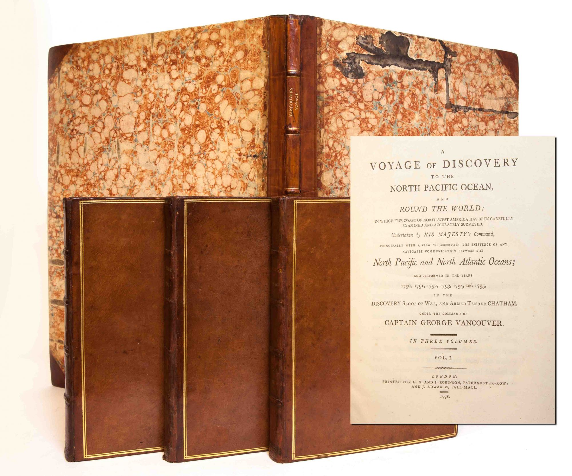
Description: 4to. A Voyage of Discovery to the North Pacific Ocean, and Round the World; In which the coast of North-West America has been carefully Examined and accurately Surveyed. Undertaken By His Majesty's Command, Principally with a view to Ascertain the Existence of any Navigable Communication between the North Pacific and North Atlantic Oceans; and performed in the years 1790. [-] 1795, in the Discovery sloop of war, and the armed tender Chatham. First edition. Three volumes. Lacking atlas volume, else apparently complete. Full speckled calf. Gilt lettering and decoration, gilt panels to boards. Extra-illustrated with unrelated period map at end of vol. III of Central Asia (from Forster, Journey from Bengal to England, London, 1798). [18] engraved plates total. Volume I: [10], xxix, [2 pp. ad], 432 pp. [7 plates]. Pencil correction to List of Plates (l. A3r). Damp staining to head at gutter. Volume II: [6], 504 pp. [5 plates]. Small perforation to p. 201, text not affected. Large tear p. 323, discreetly repaired with tape [no loss of text]. Volume III: [6], 505 pp., [3 pp. errata, 1 fold-out map]. [6 plates]. Set has been professionally rebacked. Original boards, new spine labels and gilt tooled nautical decoration to compartments, new endpapers. All volumes have wear to calf, bumping to corners, and a few small stains to edges of text blocks. Watermarks to paper with date of 1794. Offsetting from plates. Occasional staining, commensurate with age, but overall in VG condition. Ex libris stamp of Conselheiro Menonca Cortez to half-title of all volumes. This voyage became one of the most important ever made in the interest of geographical knowledge. Vancouver sailed by way of the Cape of Good Hope to Australia, where he discovered King George's Sound and Cape Hood, then to New Zealand, Hawaii, and the northwest coast of America. In three seasons' work, he surveyed the coast of California; visited San Francisco and San Diego, and other Spanish settlements in California; investigated the Strait of Juan de Fuca; discovered the Strait of Georgia; circumnavigated Vancouver Island; and disproved the existence of any passage between the Pacific and Hudson's Bay. (Hill, Pacific Voyages [2004] p. 623).
Seller: Minotavros Books, ABAC ILAB, Whitby, ON, Canada
Price: US$14995.00 + shipping
Condition: Very Good
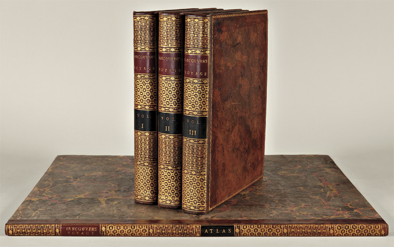
Description: 3 Volume 1st Edition Set with all Illustrations & Maps (With Tissue Guards), Orig Period Brn Leather, Gilt Title with Raised Ridges & Gilt Design on Spine, 3 Gilt Rectangular Lines around Covers with an elaborate Gilt design around Interior edges, AEG, Brn Marbled e.p., 4to (9.5 x 12.25 Inches), does not include Atlas, the heavy front covers have become unattached; otherwise the Volumes are in VG & Tight Condition, 1st ed
Seller: Larry W Price Books, Portland, OR, U.S.A.
Price: US$15000.00 + shipping
Condition: Very Good
Description: London: G. G. and J. Robinson; and J. Edwards, 1798. 3 voll. (lacking the atlas). First edition. Folio. (11 1/2" x 9 1/8", 295mm x 230mm ) With 18 engravings: 17 landscapes and one map. Bound in straight-grained red morocco gilt. Borders and fleurons gilt to the boards with gilt inside dentelles. On the spine, 5 raised bands. Title gilt to the second panel, number gilt to the fourth. All edges of the text-block gilt. Green marbled end-papers. Red marking ribbon. Armorial bookplate of Arthur Scott of Rotherfield, to all three front pastedowns. Extremities and hinges worn. Skinning to the edges of the boards. Foxing and offsetting around the engravings. The H.M.S. Discovery was commissioned in 1790 with George Vancouver(1757-1798) in command. He had sailed with Cook on his second and third voyages (1772-1774 and 1776-1780) and was made commander of a grand-scale expedition to reclaim Britain's rights, resulting from the Nootka Convention, at Nootka Sound, to thoroughly examine the coast south of 60 degrees North latitude in order to find a possible passage to the Atlantic, and to learn what establishments had been founded by other powers. His assignment was diplomatic and exploratory. The voyage became one of the most important ever made in the interests of geographical knowledge. Hill 1753; Howes V 23; Lada-Mocarski 55; Lande 1495; Sabin 98443; Staton & Tremaine/TPL 688; Wagner I, pp. 239-50.
Seller: Arader Galleries - AraderNYC, New York, NY, U.S.A.
Price: US$35000.00 + shipping
Description: 4to. 28.5 x 22.5 cm. Three volumes, with 17 engraved plates and a chart, plus folio atlas containing 16 large plates. (432 text pages and 7 plates in Volume 1; 504 text pages, 4 plates and a chart in Volume II, 508 text pages, 6 plates in Volume III,) Bound in period style calf, spines elaborately tooled. Mild browning and spotting, mostly confined to the beginning of Vol I, usual offsetting to text pages from facing plates. Forbes 298; Hill 1753.
Seller: Thomas A. Goldwasser Rare Books (ABAA), CHESTER, CT, U.S.A.
Price: US$45000.00 + shipping
Description: Atlas volume only. Folio (ca 22 4/8 x 18 inches) with 16 engraved maps, charts and coastal profiles (some occasional light soiling to maps, small holes at folds, one or two pale water stains, one small ink spot). Modern half tan calf, grey paper boards, gilt. First edition. Vancouver had served on Captain Cook's second and third voyages and "was made commander of a large-scale expedition to reestablish British rights, resulting from the Nootka Convention, at Nootka Sound; to thoroughly examine the coast south of 60o in order to find a possible passage to the Atlantic; and to learn what other establishments had been founded by other powers. This voyage became one of the most important ever made in the interests of geographical knowledge. Vancouver sailed by way of the Cape of Good Hope to Australia, where he discovered King George's Sound and Cape Hood, then to New Zealand, Hawaii, and the northwest coast of America. Vancouver surveyed the coast of California; visited San Francisco, San Diego. and other Spanish settlements in Alta California. investigated the Strait of Juan de Fuca, discovered the Strait of Georgia; circumnavigated Vancouver Island; and disproved the existence of any passage between the Pacific and Hudson Bay" (Hill). "This is one of the most important voyages for the history and the cartography of the northwest coast in general and of Alaska in particular" (Lada-Mocarski). Hill 1753; Howes V23; Lada-Mocarski 55; Lande 1495; NMM 142; Sabin 98443; Staton & Tremaine/TPL 688; Streeter sale VI:3497 (this copy); Wagner I, pp.239-50. For more information about this book, or a warm welcome to see it and other books in our library at 72nd Street, NYC, please contact Kate Hunter, M.A. Oxon, in the Rare Book Department
Seller: Arader Galleries - AraderNYC, New York, NY, U.S.A.
Price: US$45000.00 + shipping
Description: Three quarto volumes (11 3/4 x 9 3/8 inches; 299 x 239 mm) plus folio atlas volume (22 x 16 3/4 inches; 560 x 430 mm), collating: [8], xxix, [1, blank], [2, ads], [4, contents], [2, list of plates], 432; [10], 504; [10], 505, [3, errata] pp. Eighteen engraved plates, one of which is a map in the text. Ten folding maps and six plates of profiles in the atlas volume. Complete with half-titles and errata. Text volumes bound in contemporary brown polished calf with double gilt borders. Spines stamped in blind and lettered in gilt. Gilt board edges and dentelles. Marbled endpapers. All edges marbled. Blue silk place markers. Atlas bound to match in contemporary half calf over marbled boards. Outer hinges as well as heads and tails of spines of text volumes professionally repaired. Some light flaking to calf at outer hinges. Plates with some light foxing and toning. Small marginal repair to leaf Pp of volume III and small corner torn to one plate of volume III, no loss of text or engraving. Atlas with some ink staining to top edge of front board. Some foxing and toning to plates of atlas, mainly to the edges. Overall, an excellent set; tall, clean and complete. "Vancouver, who had served on Cook's third voyage, was made commander of an expedition whose express purpose was to reclaim wherever possible British rights to the Northwest Coast of America. Vancouver sailed to the Pacific via Australia, where he discovered and charted King George Sound and Cape Hood, passed Van Deiman's Land, and visited New Zealand, Hawaii and the Northwest Coast. During the course of three seasons, he surveyed Alaska and the Northwest Coast, investigated the Strait of Juan de Fuca, discovered the strait of Georgia, and circumnavigated Vancouver Island. He visited San Francisco, Monterey, and other Spanish settlements in Alta California" (Graff). "His voyage is important not only for the magnificent charts and splendid views that accompanied it, but also for the valuable and extensive amount of information that it provided on the Spanish settlements, the [Native Nations], and the physical features of the countries that he visited. It is one of the 'classics' of late eighteenth-century geographical literature.Of all modern exploring voyages to the Pacific those of Cook, La Perouse and Vancouver were the most important" (Howes). Cowan, p. 655. Graff 4456. Hill I, p. 303. Howes V23. Sabin 98443.
Seller: Whitmore Rare Books, Inc. -- ABAA, ILAB, Pasadena, CA, U.S.A.
Price: US$48000.00 + shipping
Condition: Fine
Description: 3 quarto text volumes (31.4 x 24.3 cm.) and one atlas volume (54.5 x 41.4 cm.). Text volumes: [6], xxix, [9], 432 pages, 7 leaves of plates; [8], 504 pages, 5 leaves of plates (including sea chart); and [8], 505, [3] pages, 6 leaves of plates (errata on last [3] pages); plates after W. Alexander by J. Landseer, J. Fittler and other (some foxing on the plates, with browning of facing pages as usual). Atlas volume: 10 folding charts and 6 plates of coastal profiles (charts with small old linen reinforcements, now discolored, on the versos of the fold intersections). Text volumes bound in contemporary diced calf (without half-titles), skillfully rebacked in period style; atlas volume finely bound in matching half-diced calf over marbled boards. PROVENANCE: from the library of Martin Copley, A.M. (1940-2014), British-Australian book collector, businessman, and conservationist. A HANDSOME SET, IN CONTEMPORARY BINDING, OF THE FIRST EDITION OF COMMANDER VANCOUVER S ACCOUNT OF THIS VOYAGE OF DISCOVERY. "This voyage became one of the most important ever made in the interests of geographical knowledge" (Hill). Vancouver had served on Captain Cook s second and third voyages and "was made commander of a large-scale expedition to reestablish British rights, resulting from the Nootka Convention, at Nootka Sound; to thoroughly examine the coast south of 60 degrees in order to find a possible passage to the Atlantic; and to learn what other establishments had been founded by other powers. This voyage became one of the most important ever made in the interests of geographical knowledge. Vancouver sailed by way of the Cape of Good Hope to Australia, where he discovered King George's Sound and Cape Hood, then to New Zealand, Hawaii, and the northwest coast of America. Vancouver surveyed the coast of California; visited San Francisco, San Diego. and other Spanish settlements in Alta California. investigated the Strait of Juan de Fuca, discovered the Strait of Georgia; circumnavigated Vancouver Island; and disproved the existence of any passage between the Pacific and Hudson Bay" (Hill). "This is one of the most important voyages for the history and the cartography of the northwest coast in general and of Alaska in particular" (Lada-Mocarski). On 15 December 1790 the Discovery was commissioned with Vancouver as commander in command, with the brig Chatham as consort. "Vancouver's instructions, dated 8 March 1791, were diplomatic as well as exploratory. First he was to proceed to the Sandwich Islands (Hawaii) where he was to spend the winter surveying them. He was then to proceed to the north-west coast of America, which he was to explore from 30° to 60° N looking for any water-communication which may tend, in any considerable degree, to facilitate an intercourse for the purposes of commerce, between the north-west coast, and the country upon the opposite side of the continent (Vancouver, 1.284), paying particular attention to the Strait of Juan de Fuca, just south of present-day Vancouver Island and then thought to be the entrance to a great inland sea. As convenient he was to visit Nootka Sound to receive back from the Spaniards the properties they had seized in 1789. "Vancouver sailed from Falmouth on 1 April 1791, proceeding to the north-west coast via the Cape of Good Hope. REFERENCES: Hill 1753; Howes V23; Lada-Mocarski 55; Lande 1495; NMM 142; Sabin 98443; Staton & Tremaine/TPL 688; Streeter sale VI:3497 (this copy); Wagner I, pp.239-50.
Seller: Arader Galleries - AraderNYC, New York, NY, U.S.A.

Price: US$60000.00 + shipping
Description: 4to (11 3/4 x 9 1/4 inches) and folio (22 1/2 x 17 1/2 inches). Vol. I: [8] [i]-xxix [9] [1]-432. 478 pp. 6 engraved plates by W. Alexander after H. Humphries. Vol. II: [10] [1]-504. 514 pp. 5 engraved plates by W. Alexander after T. Heddington and F. Sykes. Vol. III: [10] [1]-505 [3]. 516 pp. 6 engraved plates by W. Alexander after J. Sykes, et al. Atlas: 10 engraved folding charts, 6 engraved plates of coastal profiles, uncut, mounted on guards throughout. Half-Titles, Titles, Dedication, Introduction, Editor's Advertisement, Table of Contents, List of Plates, Books I-VI, Notes and Miscellaneous Observations, Errata. Finely bound to style in uniform red quarter morocco with tips on original grey paper boards, spine gilt-ruled into six compartments, title and volume number in gilt in second and fourth compartments, all edges sprinkled grey. Atlas with binder's ticket of "J. Tuck, Bookbinder" "One of the most important [voyages] ever made in the interests of geographical knowledge." - Hill This work, considered by Cowan to be "superior to any of its kind," documents Vancouver's voyage, which resulted in the first published map to depict Hawaii in its entirety. [Fitzpatrick] Vancouver had been put in command of the expedition related in this work on the recommendation of his old commanding officer Alan Gardner. He had served earlier with both Admiral Rodney and on James Cook's second and third voyages, so he was well experienced in addition to being a first-class navigator. Vancouver's voyage was mounted as a "grand-scale expedition to reclaim Britain's rights, resulting from the Nootka Convention, at Nootka Sound, to thoroughly examine the coast south of 60º in order to find a possible passage to the Atlantic; and to learn what establishments had been founded by other powers. Vancouver sailed by way of the Cape of Good Hope to Australia, where he discovered King George's Sound and Cape Hood, then to New Zealand, Hawaii, and the northwest coast of America. In three seasons' work Vancouver surveyed the coast of California; visited San Francisco and San Diego; and other Spanish settlements in Alta California; settled the necessary formalities with the Spanish at Nootka; investigated the Strait of Juan de Fuca; discovered the Strait of Georgia; circumnavigated Vancouver Island; and disproved the existence of any passage between the Pacific and Hudson Bay." [Hill] Cowan (1914), p.236; Cowan (1933), 654-655 pp. Cox II, p.30. DNB. Ferguson I, 281. Fitzpatrick, Early Mapping of Hawaii, 39-43 pp. Forbes I, 298. Graff, Western Americana 4456. Hill 1753. Howes V-23. JCB 2009. Jones, Americana 667. Judd 178. Lada-Mocarski 55. Lande 1495. National Maritime Museum 142. O'Reilly-Reitman 635. Sabin 98443. Smith, Pacific Northwest Americana 10469. Staton and Tremaine 688. Strathern 582. Streeter Sale 3497. Tweney 78. Wagner, Cartography of the Northwest Coast, 853-860 pp. Wantrup 63a. Wickersham 6601. Zamorano, Eighty 77.
Seller: Donald A. Heald Rare Books (ABAA), New York, NY, U.S.A.
Price: US$62500.00 + shipping
Description: Four volumes including atlas volume of plates and maps. Quarto text volumes: [8],xxix,[8],432; [10],504; [10],505,[3]pp., plus eighteen plates. Folio atlas: Ten folding engraved charts, six engraved plates of coastal profiles. Text volumes: Contemporary mottled calf, gilt, expertly rebacked to style with richly gilt spines, leather labels. Internally very clean. Atlas: Bound in matching style in quarter calf and marbled boards, spine richly gilt, leather labels. Maps and coastal profiles mounted on guards, some slight soiling on a few margins. Very good. A cornerstone work on the exploration of the Pacific and the northwest coast of America. "This voyage became one of the most important ever made in the interests of geographical knowledge" - Hill. Vancouver was put in command of the expedition on the recommendation of his former commanding officer, Alan Gardner. He had served earlier with Admiral Rodney and on James Cook's second and third voyages, so was well equipped in terms of experience; in addition, he was a first-class navigator. The voyage was mounted as a "grand-scale expedition to reclaim Britain's rights, resulting from the Nootka Convention, at Nootka Sound, to thoroughly examine the coast south of 60º in order to find a possible passage to the Atlantic; and to learn what establishments had been founded by other powers. This voyage became one of the most important ever made in the interests of geographical knowledge. Vancouver sailed by way of the Cape of Good Hope to Australia, where he discovered King George's Sound and Cape Hood, then to New Zealand, Hawaii, and the northwest coast of America. In three seasons' work Vancouver surveyed the coast of California; visited San Francisco and San Diego.and other Spanish settlements in Alta California; settled the necessary formalities with the Spanish at Nootka; investigated the Strait of Juan de Fuca; discovered the Strait of Georgia; circumnavigated Vancouver Island; and disproved the existence of any passage between the Pacific and Hudson Bay" (Hill). Vancouver must be considered, along with Cook, La Pérouse, and Malaspina, as one the greatest explorers of the late 18th century. "All four visited the northwest coast, but only Vancouver surveyed the enormous extent of the coast from Southern California to Cook Inlet.His meticulous survey literally put on the map of the world the intricacies of Puget Sound, Hood Canal, and the western coast of mainland Canada" - Tweney. COWAN (1914), p.236 ("superior to any of its kind, and constitutes the chiefest source of authority of that period"). COWAN (1933), pp.654-55. COX II, p.30 ("one of the most important voyages ever made in the interests of geographical knowledge"). FERGUSON I:281. FITZPATRICK, EARLY MAPPING OF HAWAII, pp.39- 43 ("Vancouver's voyage resulted in the first published map of Hawaii to depict the islands in their entirety"). FORBES 298. GRAFF 4456. JCB 2009. JONES 667. JUDD 178. LADA-MOCARSKI 55. LANDE 1495. NMM 142. O'REILLY & REITMAN 635. SMITH, PACIFIC NORTHWEST AMERICANA 10469. STATON & TREMAINE 688. STRATHERN 582. STREETER SALE 3497. TWENEY 78. WAGNER NORTHWEST COAST, pp.853-60. WANTRUP 63a. WICKERSHAM 6601. ZAMORANO 80, 77. A. David, "Vancouver's Methods and Surveys" in Fisher & Johnston (editors), FROM MAPS TO METAPHORS: THE PACIFIC WORLD OF GEORGE VANCOUVER (UBC Press, 1993), p.68. REESE, BEST OF THE WEST 21.
Seller: William Reese Company - Americana, New Haven, CT, U.S.A.
Price: US$85000.00 + shipping
Condition: Very Good
Description: 4 volumes [Text: 3 volumes, 4to (11 5/8 X 9 in.; 29.5 X 22.9 cm); Atlas: folio, (21 1/2 x 16 3/4 in.; 54.6 x 42.5 cm)]. TEXT: 2 (of 3) half-titles, 18 engraved plates by W. Alexander after in situ sketches by T. Heddington, H. Humphries, Z. Mudge, B. T. Pouncy, and J. Sykes and engraved by J. Landseer and others, 3-page errata at the end of vol. 3; vol. 1 lacking half-title, with light stain on p. 13 and light foxing on pp. 388-389; light scattered foxing in quires F, Z, and Ii, short marginal tear on bottom of p. 373, and pp. 426-429 spotted in upper outer corners in vol. 2; skillful repair to half-title in vol. 3, with text browning on pp. 176 and 241, offsetting from ribbon marker (no longer present) chiefly in gutter of pp. 194-195 but extending a little into the text, light marginal foxing to errata. ATLAS: 10 engraved folding charts and 6 engraved plates of coastal profiles; small hole at intersection of folds on second chart, expert repair to long tear on left margin and small hole at intersection of folds in the third chart, two other minor repairs. Modern half mottled calf over blue marbled boards, smooth spines elaborately tooled gilt, brown morocco lettering and numbering pieces, text volume edges sprinkled red. FIRST EDITION OF "ONE OF THE MOST IMPORTANT VOYAGES FOR THE HISTORY AND THE CARTOGRAPHY OF THE NORTHWEST COAST IN GENERAL AND OF ALASKA IN PARTICULAR" (Lada-Mocarski). Vancouver, a veteran of Cook's second and third voyages, was made commander of a grand-scale expedition to reclaim Britain's rights resulting from the Nootka Convention, to chart the coast of North America south of 60o in search of a passage to the Atlantic, and to learn what establishments had been founded by other powers. Vancouver sailed by way of the Cape of Good Hope to Australia, where he discovered King George's Sound in the southwest. His track then took him to New Zealand, Hawaii, and the northwest coast of America. In three seasons' work, Vancouver surveyed the coast of California, where he visited San Francisco, San Diego, and other Spanish settlements in Alta California, settled the necessary formalities with the Spanish at Nootka, investigated the Strait of Juan de Fuca, discovered the Strait of Georgia, circumnavigated Vancouver Island, and disproved the existence of a passage between the Pacific and Hudson Bay (Hill). The present work was published posthumously by his brother John, with the assistance of Captain Peter Puget, after Vancouver died less than three years after his return. REFERENCES: Graff, Western Americana 4456; Hill, Pacific Voyages (2004) 1753; Howes V-23; JCB 2009; Lada-Mocarski 55; Sabin 98443; Smith, Pacific Northwest Americana 10469; Streeter Sale 3497; Staton & Tremaine 688; Wagner, Cartography of the Northwest Coast, pp. 853-860; Zamorano Eighty, 77 PROVENANCE: The Estate of David A. Spinney (Skinner's, 30 October 2016, lot 396)
Seller: Arader Galleries - AraderNYC, New York, NY, U.S.A.