Available Copies from Independent Booksellers

Price: US$475.00 + shipping
Condition: Very Good
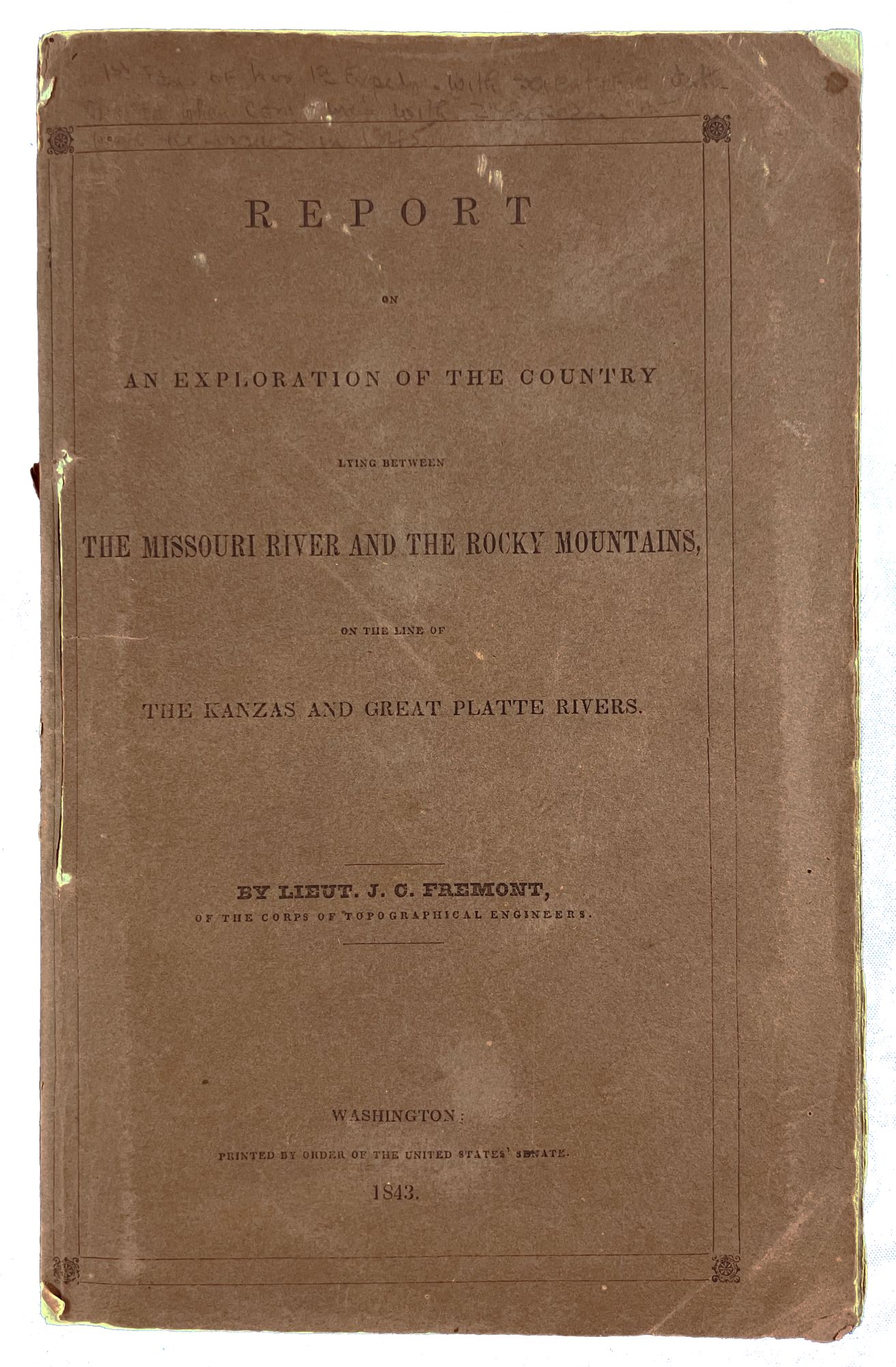
Description: Brown marbled boards backed with brown leather. 6" x 9 1/4." 207 pages, complete. Map and illustrations in facsimile: one black-and-white folding map and six plates, complete. Numbers "551; 60" on spine. Former owner's bookplate tipped in on front pastedown: "Class 551, No. 60; Union College Library; Bound by the Asa Packer Memorial Fund." Printed facsimile title label on spine. Pages very clean and intact except for slight foxing and age toning. Covers are intact overall but have a moderate amount of rubbing and multiple scratch marks. Binding is tight. A Very Good copy. Referenced in Wagner-Camp as no. 95: "[1]-13 in eights; consisting of: [1] letter of transmittal, [2] blank, leaf (front.), [3] title, [4] blank, [5] contents, [6] blank, fold. map, [7]-207, [208] blank. . Fremont's first expedition to the Rockies was designed by his father-in-law, Sen. Thomas Hart Benton, to publicize the overland route to Oregon. Dale Morgan found the manuscript of the report in the War Department records of the National Archives. Although unable to locate any of Fremont's manuscript journals, Morgan found the financial records of the 1842-45 expeditions in the old files of the General Accounting Office." The letter of transmittal preceding the title page has the following title: "27th Congress, 3d Session. [Senate.] [243] Report from the Secretary of War, Communicating, in compliance with a resolution of the Senate, a copy of Lieut. Fremont's report of his Exploring Expedition to the Rocky Mountains. March 2, 1843. Read, and ordered to be printed. March 3, 1843. Ordered, That nine hundred additional copies be furnished for the use of the Senate, and one hundred copies for the use of the Topographical Bureau." Within the letter of transmittal, J. J. Abert, Colonel Corps of Topographical Engineers, writes, "I have the honor to transmit the report and map of an exploring expedition to the Rocky Mountains, made during the last summer, under the orders of the Department, by Lieut. J. C. Fremont, of the Corps of Topographical Engineers, and which was called for by a resolution of the Senate of the 21st of last December. Although so much time has elapsed since the calling for the report, allow me to say that it was not owing to any want of industry on the part of Lieut. Fremont, but to the great amount of matter which had to be introduced in the report, and the many calculations which had to be made of the astronomical and barometrical observations. The necessary labor on these accounts has delayed the completion of the report until to-day." Secretary of War named as J. C. Spencer.
Seller: Barry Cassidy Rare Books, Sacramento, CA, U.S.A.
Price: US$2500.00 + shipping
Condition: Fine
Description: Reduced and complied under direction of Col. J.J. Abert in the Bureau of the Corps of Topographical Engineers by Lieut W. H. Emory from maps published in 1842 and other authorities in 1843, published by order of the U.S. House of Representatives. Observations, Surveys, and Information from J.N. Nicollet were done in the years 1836-40 and assisted with in 1838-4 by Lieut J. C. Fremont of the Corps of Topographical Engineers under the superintendence of the Bureau of the Corps of Topographical Engineers and authorized by the War Department. This is the first accurate hydrographic mapping of the central United States. Very large engraved folding map of the upper Mississippi basin, paper measuring approx. 97 x 84 cm and covering a large geographical area from St. Louis in the south to Rainy Lake in the north; and from Madison in the east to "Pawnee Indian Country" in the west. Publication containg this map is [Howes N152], [Wagner-Camp 98], [Sabin 55257], [Graff 3022]. Nicollet brought from France the knowledge of how to use a barometer to measure altitude (hypsometry). Thus this extremely important map is the first fruit of this technique outside Europe. This map was the first detailed modern depiction of the Great Lakes region and the primary source for the area at that time. Goetzmann states that Nicollet's "Map of the Hydrographic Basin of the Upper Mississippi River" was "based on some 90,000 instrument readings and 326 distinctly determined astronomical points. With its overall regional concept of a 'hydrographic basin,' Nicollet's map and the accompanying report were years ahead of their time. Had he lived one more decade, Nicollet would undoubtedly have become the official government cartographer of the whole trans-Mississippi West". John Charles Fremont (1813/01/21-1890/07/13) was given a chance to serve with Nicollet by Joel Roberts Poinsett (1779/03/02-1851/12/12; for whom the Poinsettia is named) where he learned the basics of scientific surveying and exploration. Without the fame won as the result of this training he would not have become the first Presidential candidate of the Republican Party. Shipping: This map has been flat in one of my map cases for 40 years in an acid free folder. I will roll it in a large map tube so that it will lie flat again if unpacked soon. It was originally folded. Refolding is NOT recommended!
Seller: T. W. Palmer Books, Eugene, OR, U.S.A.
Price: US$3500.00 + shipping
Description: 8vo., (8 6/8 x 5 6/8 inches). Fine large engraved folding map on two sheets, joined (some minor spotting) of the Hydrological Basin of the Upper Mississippi by Emory after Nicollet, and additionally illustrated with the large lithographed folding map ". of Oregon and Upper California from the Surveys of John Charles Fremont. 1848" with original hand-colour in outline. Original maroon cloth (spine faded, joints cracked). "THE EARLIEST ACCURATE MAP OF THE EASTERN SEABOARD OF THE CENTRAL PLAINS" (Ehrenberg) First edition, Senate issue with a larger map than in the House issue, extra-illustrated with Fremont's map of Oregon and California "The one great general map of 1848 was that of Fremont and Preuss." (Wheat). Nicollet, a French-born scientist and would-be astronomer, arrived in New Orleans in 1832 and soon became intimate with the wealthy Chouteau family, who were preeminent in controlling the fur trade of the Mississippi Valley, with operations extending northward into the Illinois country. They persuaded him to join them in expeditions they were sending into the St. Louis region. "Nicollet embarked on the first of these explorations in 1836, searching for the source of the Mississippi River. In this quest he came into contact with the Chippewa Indians and reported his findings on their language, customs, religious practices, relations with other tribes, and attitudes toward American settlers to U.S. Army officers stationed at Fort Snelling, at the juncture of the Mississippi and Minnesota rivers, the site of present-day Minneapolis. Nicollet impressed his new American friends in the U.S. Army. As a result of their recommendations Secretary of War Joel Poinsett invited him to Washington, D.C., and gave him various assignments. One of these in 1838 was a commission to conduct a survey of the upper Missouri country, accompanied by Lieutenant John C. Frémont. In the following year he continued the survey by steamboat and also explored the sources of the Red River and the North Dakota country. When he returned to Washington, D.C., in 1840, he prepared some of the first accurate maps of the region northwest of the Mississippi River. In these projects he worked closely with the eminent Swiss émigré Ferdinand Hassler, chief of the U.S. Coast Survey.The significance of Nicollet's life in the United States was as an explorer and mapmaker. A scientist of note, he was one of the illustrious circle of talented, adventurous, and highly skilled men who gathered around Hassler. That group developed the first accurate scientific data about the still-unknown regions of the Mississippi Valley. In his brief career as a pioneer explorer he contributed much to westward expansion in the nineteenth century and to more accurate knowledge of the Native Americans in that area" (Gerald D. Nash for ADNB). Nicollet's celebrated "Map of the Hydrographic Basin of the Upper Mississippi River", reduced by Emory and first published separately in 1842, was "based on some 90,000 instrument readings and 326 distinctly determined astronomical points. With its overall regional concept of a 'hydrographic basin,' Nicollet's map and the accompanying report were years ahead of their time. Had he lived one more decade, Nicollet would undoubtedly have become the official government cartographer of the whole trans-Mississippi West" (Goetzmann, Exploration and Empire, 1993, p. 313). Fremont's map is extremely important to the development of the westward expansion. It provides a major contribution to geographical and cartographical knowledge and is an historic record of Fremont's third expedition and as such is considered one of the most important 19th-century American maps. It covers all of the western territories from the 105th Meridian. It names the "Golden Gate" at the entrance to the Bay of San Francisco, the markings of the El Dorado or Gold Region in the California Gold Fields, a hypothetical east-west mountain range near the 42nd parallel, and a notation identi
Seller: Arader Galleries - AraderNYC, New York, NY, U.S.A.
Price: US$7500.00 + shipping
Description: (8 3/4 x 5 1/2 inches). First Edition. 207 pp. with lithographed hand-colored folding map and six plates, three of which are tinted. Stitched in original brown printed paper wrappers, in a custom gilt brown morocco-backed clamshell case First edition of the report on Fremont's first expedition to the Rocky Mountains, in the rare original printed paper wrappers. Frémont's first expedition was an ambitious undertaking commissioned by the U.S. Army's Corps of Topographical Engineers. Its primary objectives were to survey and map parts of the American West and to assess the feasibility of potential transcontinental railroad routes. Frémont led the expedition accompanied by key figures including the German mapmaker Charles Preuss, who served as his assistant topographical surveyor, Lucien B. Maxwell of Kaskaskia, Illinois, who was engaged as a hunter, and the legendary frontiersman Kit Carson who acted as the guide. The rest of the small party of some twenty men included those from the St. Louis, Missouri area, principally Creole and Canadian voyageurs who had become familiar with prairie life in the service of the fur companies in the Indian country. The expedition explored various regions of the American West, including the Oregon Trail through the South Pass, the Wind River Valley, and several rivers and mountain ranges. They reached as far west as the Wind River Range in present-day Wyoming. One of the notable events during the expedition was the climbing of what is now known as Frémont's Peak in Wyoming. At its summit, Frémont planted an American flag, symbolically claiming the Rocky Mountains and the West as United States Territory. Upon his return home to Washington, DC, Frémont dictated much of the report to his wife, Jessie Benton Frémont, a political activist and gifted writer. "The horseback life, the sleep in the open air," she later recalled, "had unfitted Mr. Frémont for the indoor work of writing." Therefore, Jessie, intensely interested in the details of his expedition, became his recorder, making notes as he described his experiences. Adding human-interest touches to these printed reports, of which the present work is the pivotal first, she wrote and edited best-selling stories of the adventures Frémont had while exploring the West. The public's eagerness for more information coincided with a time when the concept of Manifest Destiny was becoming increasingly popular and these narratives were received with great enthusiasm. This first edition of Frémont's report serves to mark the beginning of the public's changing attitudes towards what was formerly perceived as the untamed and dangerous American West. This report stands as a vital document that significantly contributed to the watershed moment of Westward expansion that led to American prosperity but also to the devastating displacement of many indigenous populations, making it a highly significant and complex publication in American history. Howes F371; Wagner-Camp 95; Streeter 'Sale' 3130; Graff 1437; Sabin 25843; Wheat Transmississippi West 464; Wynar Colorado 203; Bradford 1784.
Seller: Donald A. Heald Rare Books (ABAA), New York, NY, U.S.A.
Price: US$8500.00 + shipping
Description: 8vo., (9 x 5 4/8 inches). Fine large engraved folding map of the Hydrological Basin of the Upper Mississippi by Emory after Nicollet (two sheets joined, some minor browning at folds). Modern sheep antique (a little scuffed at the extremities). "THE EARLIEST ACCURATE MAP OF THE EASTERN SEABOARD OF THE CENTRAL PLAINS" (Ehrenberg) First edition, Senate Issue. Nicollet, a French-born scientist and would-be astronomer, arrived in New Orleans in 1832 and soon became intimate with the wealthy Chouteau family, who were preeminent in controlling the fur trade of the Mississippi Valley, with operations extending northward into the Illinois country. They persuaded him to join them in expeditions they were sending into the St. Louis region. "Nicollet embarked on the first of these explorations in 1836, searching for the source of the Mississippi River. In this quest he came into contact with the Chippewa Indians and reported his findings on their language, customs, religious practices, relations with other tribes, and attitudes toward American settlers to U.S. Army officers stationed at Fort Snelling, at the juncture of the Mississippi and Minnesota rivers, the site of present-day Minneapolis. Nicollet impressed his new American friends in the U.S. Army. As a result of their recommendations Secretary of War Joel Poinsett invited him to Washington, D.C., and gave him various assignments. One of these in 1838 was a commission to conduct a survey of the upper Missouri country, accompanied by Lieutenant John C. Frémont. In the following year he continued the survey by steamboat and also explored the sources of the Red River and the North Dakota country. When he returned to Washington, D.C., in 1840, he prepared some of the first accurate maps of the region northwest of the Mississippi River. In these projects he worked closely with the eminent Swiss émigré Ferdinand Hassler, chief of the U.S. Coast Survey.The significance of Nicollet's life in the United States was as an explorer and mapmaker. A scientist of note, he was one of the illustrious circle of talented, adventurous, and highly skilled men who gathered around Hassler. That group developed the first accurate scientific data about the still-unknown regions of the Mississippi Valley. In his brief career as a pioneer explorer he contributed much to westward expansion in the nineteenth century and to more accurate knowledge of the Native Americans in that area" (Gerald D. Nash for ADNB). Nicollet's celebrated "Map of the Hydrographic Basin of the Upper Mississippi River", reduced by Emory and first published separately in 1842, was "based on some 90,000 instrument readings and 326 distinctly determined astronomical points. With its overall regional concept of a 'hydrographic basin,' Nicollet's map and the accompanying report were years ahead of their time. Had he lived one more decade, Nicollet would undoubtedly have become the official government cartographer of the whole trans-Mississippi West" (Goetzmann, Exploration and Empire, 1993, p. 313). Buck 339. Graff 3022. Howes N152; Schwartz & Ehrenberg (Plate 165), pp. 265-68; Sabin 55257; Streeter III:1808; Wagner-Camp-Becker 98; Wheat, Transmississippi West II, p. 180. Catalogued by Kate Hunter.
Seller: Arader Galleries - AraderNYC, New York, NY, U.S.A.